
⭐ Utility Trenching • Underground Utility Excavation • Electrical & Water Line Trenches • Rural Utility Routes Across Apache County Arizona
Professional Utility Trenching & Underground Utility Excavation in Apache County, Arizona
Professional utility trench excavation for rural properties throughout Apache County, including electrical service routes, water lines, communications conduit, underground utility corridors, rural homesites, cabins, ranch properties, manufactured homes, and off-grid development. Trenching is planned around terrain, soil, rock, drainage, access, and the location of existing and future property improvements.
Serving St. Johns, Concho, Vernon, Sanders, Springerville, Eagar, Alpine, Greer, Nutrioso, McNary, Ganado, Window Rock, and surrounding Apache County communities.
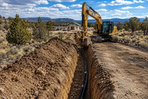
What Utility Trench Excavation Actually Involves
Utility trench excavation is the controlled earthwork used to create underground pathways for electrical service, water lines, communications conduit, and other rural infrastructure. On Apache County properties, those routes may extend from a road or service connection to a remote homesite, from a private well toward a house pad, between a residence and outbuilding, or across undeveloped acreage to support phased rural or off-grid development.
Rural utility trenching is rarely as simple as following the shortest line between two points. The practical route may need to work around existing driveways, future building locations, septic areas, wells, drainage features, slopes, property access, and other planned improvements. Establishing the route before major site improvements are completed can help reduce the need to cut through a finished driveway, disturb a prepared building area, or excavate the same portion of the property multiple times as development progresses.
Apache County's rural development conditions make route planning particularly important. Some rural areas have limited utility availability, and extending service to remote properties can involve substantial excavation, materials, equipment access, and coordination with the applicable utility provider or qualified installation contractor.
Ground conditions can also change along a single utility route. Depending on the property, excavation may encounter workable native soil, caliche, shallow or volcanic rock, coarse material, dense ground, slopes, or difficult access. Long rural runs should therefore be evaluated according to the actual proposed route rather than assuming uniform excavation conditions across the entire property.
Common components of rural utility trench excavation include:
-
Electrical Service Trenches
Excavation for underground electrical conduit between an approved service point, electrical equipment, residence, cabin, workshop, manufactured home, barn, or other rural structure. The excavation route should be coordinated with the planned building area, driveway, drainage, and other utilities. Electrical design, conduit, wiring, connections, and required electrical work remain subject to the applicable project requirements and qualified electrical professionals. -
Water Line Trenches
Underground excavation for water lines connecting a private well or other approved water source with a residence, cabin, shop, livestock facility, or other improvement. On rural Apache County acreage, the route should be considered in relation to the well location, house pad, driveway, septic area, grades, and future development. Water-system design, sizing, connections, and plumbing requirements depend on the specific installation. -
Communications & Data Conduit
Trenching for communications conduit, data pathways, control wiring, security systems, internet-related infrastructure, and other low-voltage routes. Installing these pathways during initial property development can reduce the need to disturb completed driveways, landscaped areas, building sites, or other finished improvements later. -
Rural Utility Corridors
Larger rural parcels may benefit from a planned underground corridor serving multiple destinations rather than treating every utility as a completely separate excavation. A logical route can connect a property entrance, future homesite, well, septic area, outbuildings, solar equipment, and other planned infrastructure as development progresses. -
Off-Grid Property Utility Routes
Off-grid properties often have several improvements separated across the parcel. Trenching may connect solar or electrical equipment, a residence, workshop, cabin, well system, or detached structure. Long distances, remote access, staging, and future expansion can all influence the practical route. -
House Pad to Well, Septic & Infrastructure Connections
Utility routes frequently have to connect a prepared house pad with infrastructure located elsewhere on the property. Planning these connections alongside the building pad, well, septic area, driveway, and other improvements can reduce unnecessary crossings and repeated excavation as the homesite moves from earthwork into construction. Septic systems themselves remain subject to applicable design, permitting, and inspection requirements. -
Rocky Ground, Caliche & Difficult Excavation
Utility routes may encounter shallow rock, volcanic material, coarse rock, caliche, or other dense subsurface conditions. Difficult material can reduce excavation production, increase equipment requirements, affect spoil handling, and change the practical excavation approach along different portions of the trench. -
Long Rural Utility Runs
A utility trench serving a remote Apache County homesite can extend substantially farther than a typical urban residential connection. Long runs make equipment access, route alignment, spoil placement, staging, crossings, grade changes, and final surface restoration increasingly important to the excavation plan. -
Trench Depth & Width Considerations
Trench dimensions depend on the utility being installed, required burial depth, installation method, ground conditions, working space, crossings, and applicable project requirements. There is no single depth or width that applies to every electrical, water, communications, or multi-utility trench. -
Utility Separation & Route Coordination
When multiple underground utilities serve the same rural property, their routes should be coordinated before excavation. Separation, crossings, access points, future expansion, easements, and the requirements of each individual utility can affect where the trench should be placed. -
Backfilling & Surface Restoration
After the underground installation is completed, the disturbed trench area may require appropriate backfill, compaction, grading, and surface restoration. Restoration becomes especially important where a utility crosses a driveway, access road, building area, drainage feature, or other previously prepared portion of a rural property. -
811 Utility Location & Private Facilities
Arizona 811 should be contacted before covered excavation to identify underground facilities that fall within the one-call system. However, Arizona 811 explains that utility owners generally cannot locate privately owned facilities on private property. Private water, electrical, communications, irrigation, or other buried lines may therefore require a separate private locating process before excavation. -
Permitting, Inspections & Utility Requirements
Requirements vary according to the utility, property, route, right-of-way, easements, service provider, and type of installation. Apache County handles applicable building and electrical permitting through Community Development, while septic and other onsite wastewater systems have separate permitting and inspection requirements. Utility-provider approvals, inspections, engineering, or other documentation may also apply to a particular project. -
Utility Route Layout & Field Marking
Before excavation begins, the proposed trench alignment should be clearly established in relation to the property, existing improvements, planned structures, access routes, and other underground infrastructure. Clear field layout can help identify unnecessary bends, crossings, conflicts, and difficult sections before equipment starts digging. -
Excavated Material & Spoil Management
Trenching produces a continuous line of excavated material that has to be managed along the route. On larger rural properties, spoil placement can affect driveway access, equipment movement, drainage, adjacent improvements, and final restoration. The material also needs to be evaluated before assuming it is appropriate for trench backfill. -
Drainage, Slopes & Trench Routing
A utility trench can cross changing grades, drainage paths, washes, or sloping ground. Route selection should account for how the excavation interacts with existing water movement and finished site grades. On Apache County acreage, this becomes especially important where utilities approach homesites through sloping or naturally draining terrain. -
Equipment Access & Remote Property Staging
Remote utility routes can require equipment to travel beyond an established driveway or construction area. Gate width, road conditions, slope, turning space, staging locations, and the distance between the equipment and excavation area can all influence how efficiently a long rural trench can be completed. -
Trench Crossings & Existing Improvements
Utility routes may have to cross driveways, access roads, drainage improvements, property entrances, or other previously constructed features. These crossings should be identified during route planning so the excavation, installation, backfill, and restoration work can be coordinated rather than treated as unexpected interruptions.
Not every utility trenching project requires all of these components. A short water-line trench across accessible ground can have a very different scope from a long multi-utility corridor crossing remote Apache County acreage. Utility type, route length, required installation depth, access, ground conditions, crossings, spoil handling, and restoration requirements all affect the actual excavation work.
For rural property owners, the important decision is often not simply where the trench starts and ends, but how the underground route fits into the property's larger development plan. A well, house pad, driveway, septic system, solar equipment, workshop, and future structures can all influence the practical location of underground utilities.
Planning those relationships before excavation can reduce repeated disturbance and make later phases of rural development easier to execute. This is particularly valuable on larger Apache County parcels where utilities may need to travel significant distances between separate improvements.
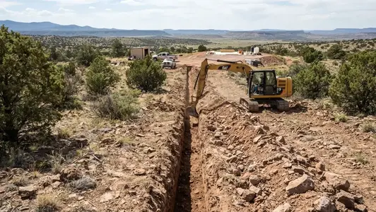
Rural utility trench excavation involves establishing the planned alignment, excavating through the property's actual ground conditions, managing spoil and equipment access, and preparing the trench corridor for the planned underground utility installation.
Planning a Utility Trench on Your Apache County Property?
Whether you need a short water-line trench, a long electrical service run, communications conduit, or a coordinated utility corridor across rural acreage, the excavation scope depends on the actual route, ground conditions, access, crossings, and planned improvements on the property.
Call (928) 543-6447Electrical Service Trenches for Rural Apache County Properties
Underground electrical service can be an important part of developing rural property, particularly when the future building site is located away from the property entrance, existing electrical infrastructure, or approved service connection point.
The excavation route should be considered before the house pad, driveway, finished landscaping, and other permanent improvements are completed. On a large Apache County parcel, the shortest line is not necessarily the best line. A route that follows an existing access corridor or planned utility corridor may reduce future disturbance and make additional infrastructure easier to coordinate.
Trenching for electrical service provides the excavated pathway for the electrical installation. Conduit, conductors, connections, service equipment, inspections, and electrical work must follow the requirements applicable to the specific project and should be handled by the appropriate qualified professionals where required.
Important considerations for rural electrical trench excavation include:
-
Service Connection Location
The trench route begins with the approved service point and the intended location of the electrical equipment or structure being served. The excavation plan should account for the actual service layout rather than assuming the nearest point on the property boundary is automatically the best route. -
Electrical Route Planning
On large Apache County parcels, the shortest route is not always the most practical. Existing driveways, future building areas, drainage paths, property access, wells, septic areas, and other planned utilities can influence where the electrical trench should run. -
Driveway & Access Crossings
Electrical service may need to cross an existing or planned driveway or private access road. These crossings should be identified before excavation so trenching, installation, backfilling, and restoration can be coordinated with the finished access surface. -
House Pad Coordination
The electrical trench should be considered in relation to the proposed building pad and finished structure location. Establishing the utility corridor before final grading can help avoid unnecessary excavation through a completed homesite. -
Rock, Caliche & Ground Conditions
Rural excavation conditions can change along the route. Caliche, shallow rock, volcanic material, coarse ground, and dense native material can affect excavation production and the equipment required to complete different portions of a long trench. -
Required Trench Dimensions
Trench depth and width are determined by the electrical installation requirements, conduit configuration, ground conditions, crossings, and applicable standards. There is not one universal trench dimension for every rural electrical service installation. -
Coordination With Other Utilities
Electrical routes may share a larger utility-planning corridor with water, communications, and other infrastructure. Required separation, crossings, access, easements, and future expansion should be considered before excavation begins. -
811 & Private Utility Locating
Underground facilities should be addressed before excavation. Arizona 811 can identify participating utility facilities within its system, while privately owned underground lines on rural property may require separate locating arrangements. -
Backfill & Surface Restoration
Once the electrical installation has been completed, the disturbed trench may require appropriate backfilling, compaction, grading, and restoration. This is particularly important where the trench crosses an established driveway, access route, or other finished area. -
Permitting & Electrical Coordination
Electrical service requirements can involve the utility provider, applicable permits, inspections, service equipment requirements, and qualified electrical work. Trench excavation should be coordinated with the overall electrical installation rather than treated as an isolated digging operation.
Plan the Electrical Route Before Final Site Work
If a driveway, house pad, septic area, well, or other improvement is already finished, changing an underground utility route can mean cutting through work that was just completed. Establishing the intended electrical corridor early can help reduce unnecessary re-excavation and surface disturbance later.
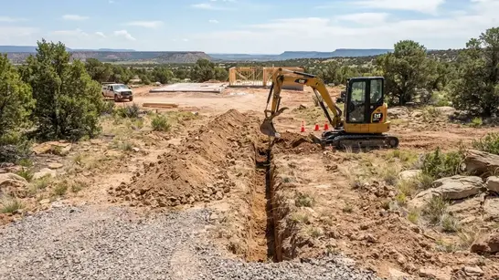
Electrical service trenches can connect a rural property entrance or approved service point with a homesite, cabin, workshop, or other structure while being coordinated with driveways, future improvements, and other underground utility routes.
Need an Electrical Service Trench?
If your rural Apache County property needs an underground electrical route to a home, cabin, workshop, manufactured home, or other structure, we can help with the excavation needed to establish the planned trench corridor.
Call (928) 543-6447Water Line Trenches From Wells to Rural Homes and Buildings
A private well is only one part of a rural water system. Once a well is developed, an underground water line may still need to carry water from the well equipment to the residence, cabin, workshop, livestock area, or other approved point of use. On Apache County properties, that connection can become a significant trenching project when the well and building areas are separated by long distances.
The water-line route should be considered together with the location of the well, house pad, driveway, septic area, electrical service, drainage features, and future improvements. On larger rural parcels, planning the route early can help avoid placing a water line beneath a future driveway or forcing excavation through a completed building area later.
Excavation conditions can also change substantially along a rural water-line route. Slopes, caliche, shallow rock, volcanic material, drainage crossings, existing access roads, gates, and limited equipment staging can all affect the trenching work. The excavation scope should therefore be based on the actual route rather than assuming uniform soil and access conditions across the property.
Common rural water-line trenching applications include:
-
Well-to-House Water Lines
Trenching between a private well system and a residence or prepared homesite. The route should account for the well location, house-pad elevation, driveway, septic area, electrical service, and future property improvements. -
Well-to-Cabin & Rural Residence Connections
Remote cabins and rural residences may require longer underground water routes when the building site is positioned away from the well. Long-distance runs can make route alignment, equipment access, grade changes, and surface restoration more important to the excavation plan. -
Water Lines to Shops & Outbuildings
Detached workshops, garages, barns, and other rural structures may require separate water connections. Planning these routes with the property's overall utility layout can reduce future excavation when additional buildings are added. -
Ranch & Livestock Water Routes
Rural properties may have water needs outside the primary residence, including approved livestock facilities and agricultural improvements. Trench alignment should consider fencing, access roads, gates, drainage, and future expansion of the property. -
Long Rural Water-Line Runs
A well located far from the homesite can create hundreds or thousands of feet of trenching. Longer routes increase the importance of equipment mobilization, spoil placement, access, route consistency, crossings, and restoration. -
Rock, Caliche & Difficult Ground
Portions of a water-line route may encounter caliche, shallow rock, volcanic material, coarse native material, or other dense ground. These conditions can change excavation production and equipment requirements along different portions of the same trench. -
Water Lines Crossing Driveways & Access Roads
A water route may need to cross an existing or planned driveway or private access road. Crossings should be coordinated with the finished grade, road base, drainage, and restoration requirements so the utility installation does not unnecessarily compromise the access route. -
Drainage & Wash Considerations
Natural drainage paths and seasonal runoff should be considered when selecting a water-line route. Apache County's high-desert terrain can include washes, slopes, concentrated runoff, and changing grades that influence where underground utilities can be practically installed and restored. -
Coordination With Other Underground Utilities
Water lines may share a broader utility corridor with electrical, communications, or other underground infrastructure. Utility separation, crossings, access points, future expansion, and the requirements of each individual system should be coordinated before excavation begins. -
Water Routes for Phased Rural Development
A property may begin with a well and one homesite but eventually include additional cabins, workshops, agricultural improvements, or other structures. Considering potential future destinations while the property is being developed can reduce repeated trenching and unnecessary disturbance later.
The Well Location Does Not Determine the Best Trench Route by Itself
On rural Apache County acreage, the most direct line between a well and a house is not always the most practical excavation route. The proposed path may need to work around a driveway, septic area, drainage feature, steep grade, existing utility, property access limitation, or future building location.
For that reason, the water-line trench is best considered as part of the property's larger development layout. Establishing the well, homesite, driveway, septic area, electrical service, and future improvements together can help reduce unnecessary crossings and repeated excavation.
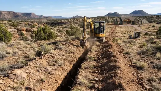
Rural water-line trenching may connect a private well with a homesite, cabin, workshop, livestock facility, or other approved point of use, with the route coordinated around access, drainage, septic areas, and future property improvements.
Communications & Data Conduit Trenching in Apache County
Communications conduit provides an underground pathway for internet, data, security, communications, control wiring, and other low-voltage infrastructure. On rural Apache County properties, these pathways may need to connect a residence with a detached workshop, gate, office, communications equipment, or other improvements separated by substantial distances.
Internet & Communications Conduit
Underground conduit can provide a protected pathway between a service entrance, residence, communications equipment, or another approved connection point. Rural properties may require longer routes than conventional residential lots, making route alignment and equipment access important parts of the excavation plan.
Security Cameras & Gate Systems
Remote gates, security cameras, monitoring equipment, and access-control systems may be positioned well away from the main residence. Underground conduit can provide a practical pathway between those locations and the equipment serving them.
House-to-Outbuilding Connections
Workshops, detached garages, cabins, offices, barns, and other rural buildings may need communications connections back to the primary residence or network equipment. Planning these routes with the property's future building layout can reduce repeated excavation as additional structures are developed.
Driveway & Access Route Crossings
A communications route may need to cross a private driveway or rural access road. Installing the pathway before final road construction can avoid cutting through completed gravel, road base, or other finished access improvements later.
Coordination With Other Utilities
Communications conduit may share a broader utility corridor with electrical service, water lines, or other underground infrastructure. Utility crossings, separation, access points, and future expansion should be coordinated before excavation rather than discovering conflicts after the trench has already been dug.
Future Communications Expansion
Rural properties are often developed in phases. A property that begins with one residence may eventually include workshops, cabins, gates, cameras, offices, or additional structures. Planning the communications corridor with future destinations in mind can reduce unnecessary disturbance later.
Rocky & Caliche Ground
Communications trenches can encounter caliche, shallow rock, volcanic material, coarse native ground, and other difficult excavation conditions across Apache County. Hard or dense material can affect excavation production, equipment requirements, spoil handling, and the amount of time required to establish the conduit pathway.
Long Rural Conduit Runs
On larger Apache County parcels, communications equipment and buildings may be separated by hundreds or thousands of feet. Longer runs make route consistency, equipment staging, access, bends, crossings, and future maintenance more important than they would be on a small residential lot.
Plan the Communications Route Before the Property Is Finished
Communications trenching is easiest to coordinate while the property's major improvements are still being planned. A driveway, house pad, parking area, drainage feature, septic installation, or landscaping project can make a previously simple conduit route much more disruptive to install.
For larger rural and off-grid properties, it can be useful to identify the likely locations of the residence, workshops, gates, communications equipment, and future structures before establishing the excavation corridor. That allows the conduit route to become part of the property's overall utility plan instead of an installation that has to be added after the major site work is already complete.
Planning Rural Utility Corridors Across Apache County Acreage
A rural utility corridor is a planned pathway across the property where underground infrastructure can be installed and coordinated without repeatedly disturbing unrelated portions of the land. This becomes especially useful when a large Apache County parcel will be developed in multiple stages rather than improved all at once.
A property entrance, future house pad, private well, septic area, solar equipment, workshop, cabin, livestock area, and other improvements may be separated by substantial distances. The utility corridor should therefore be considered as part of the overall property layout rather than simply choosing the shortest route between two individual connection points.
Good corridor planning also considers what may be built later. A route that works for today's house and well may create problems when a workshop, second structure, additional communications equipment, or other improvement is added. Establishing logical utility pathways early can reduce repeated excavation and help protect completed site work.
1. Identify the Major Destinations
Start with the locations that utilities may need to serve: the property entrance, house pad, well, septic area, electrical service, solar equipment, workshops, cabins, gates, and other planned improvements. Future structures should be considered when they are reasonably foreseeable.
2. Establish Practical Utility Routes
The shortest line is not always the best corridor on rural acreage. Existing driveways, slopes, drainage paths, property access, gates, building locations, difficult ground, and future construction areas can all influence where utilities should be routed.
3. Coordinate With the Driveway
Utility corridors frequently interact with private driveways and access roads. Planning those crossings before final road construction can reduce the need to cut through completed gravel, road base, drainage improvements, or other finished access work.
4. Coordinate Well & Septic Locations
Water and wastewater infrastructure can strongly influence the usable layout of a rural homesite. Utility routes should be considered alongside the well, septic area, house pad, access, and required separation or setback requirements rather than treating each improvement as an unrelated project.
5. Coordinate Multiple Utilities
Electrical, water, communications, and other underground systems may serve the same general area. Their individual burial, separation, crossing, easement, and installation requirements need to be coordinated before excavation so one utility does not create a conflict with another.
6. Allow for Future Development
Rural properties are often developed over several years. A corridor planned around the initial homesite can also account for likely future workshops, cabins, gates, agricultural improvements, additional buildings, or expanded utility needs.
7. Account for Apache County Terrain
Utility corridors may cross changing ground conditions, including slopes, caliche, shallow rock, volcanic material, drainage features, and areas with limited equipment access. A practical corridor needs to work with the actual terrain rather than assuming the property is uniformly excavatable.
8. Plan Construction Access & Restoration
Long rural trench projects require room for excavation equipment, spoil placement, material handling, and access along the route. The final plan should also consider how disturbed areas will be backfilled, compacted, graded, and restored after the underground installation is completed.
Think About the Property as a System
A good utility corridor does not simply connect Point A to Point B. It considers what may eventually be built between those points and how each improvement affects the next. On a large Apache County property, the house pad, driveway, well, septic system, electrical service, communications, solar equipment, and future structures can all influence the most practical utility route.
Planning these relationships before major site work begins can reduce repeated excavation, protect completed improvements, and make phased rural development more predictable.
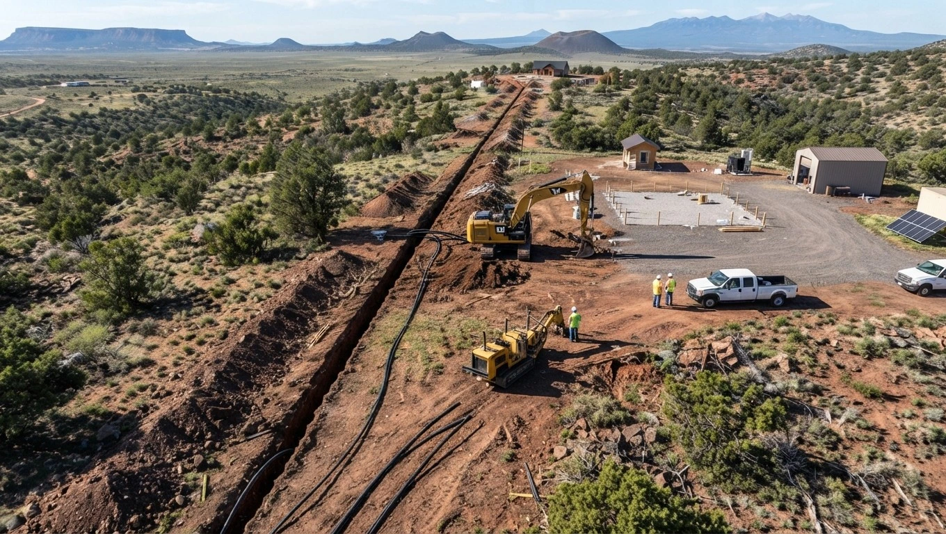
A planned rural utility corridor can coordinate electrical, water, communications, and future infrastructure routes across large Apache County properties while reducing unnecessary crossings and repeated disturbance.
Planning Utilities Across a Larger Apache County Property?
If your property will need electrical, water, communications, solar, or other underground infrastructure across rural acreage, planning the utility corridor before major site work can help reduce unnecessary crossings, repeated excavation, and disturbance to completed improvements.
Call (928) 543-6447Off-Grid Property Utility Routes in Apache County
Off-grid development often involves several separate infrastructure systems that have to work together across undeveloped acreage. Utility trenching can provide the underground connections between those systems while keeping the property's future off-grid land development plan in mind.
A typical off-grid property may have a house pad in one location, a private well in another, solar equipment positioned for energy production, a septic area separated from the residence, and additional buildings located elsewhere on the parcel. Underground electrical, water, communications, and other utility routes may therefore extend substantial distances between individual components.
Apache County properties can also present very different excavation conditions along a single route. A trench between a homesite and remote infrastructure may cross native soil, caliche, rock, uneven terrain, drainage features, existing access roads, or areas where equipment access is limited. Route planning and equipment access should therefore be considered before excavation begins.
Solar & Electrical Equipment
An off-grid electrical system may place solar arrays, batteries, inverters, service equipment, and the primary residence in different locations. Underground electrical pathways can be planned around those components according to the system design, equipment locations, and applicable electrical requirements.
Private Well to Homesite
A private well may be located away from the house pad, requiring an underground water route between the well equipment and the residence or other approved point of use. The route should be considered alongside the driveway, septic area, building pad, future structures, and property grades.
Septic & Utility Coordination
The approved septic area occupies part of the property's overall development layout. Utility routes should be planned with the septic system location and required areas in mind so electrical, water, communications, access, and drainage improvements do not create unnecessary conflicts with the wastewater system.
Remote Homes & Cabins
Cabins, rural residences, manufactured homes, and other remote structures may sit well beyond the property entrance or primary access road. Longer underground routes make alignment, equipment access, spoil handling, crossings, and restoration more important than they would be on a compact residential lot.
Workshops & Outbuildings
Shops, garages, barns, agricultural buildings, and other outbuildings may be added after the primary homesite is established. Planning potential utility destinations early can help avoid placing a future trench through a completed driveway, building area, or other finished improvement.
Phased Rural Development
Large Apache County parcels are often developed in stages rather than all at once. Establishing logical utility corridors early can help connect today's improvements while leaving practical routes for future buildings, water infrastructure, electrical systems, communications, and other planned development.
Plan the Off-Grid Property Before You Dig
On a remote parcel, the best trench route is not always the shortest distance between two improvements. The location of the house pad, well, septic system, solar equipment, driveway, drainage features, workshops, and future structures can all influence where underground utilities should run.
Thinking about those relationships before excavation begins can reduce repeated digging and help prevent a future utility installation from crossing a finished driveway, building pad, drainage improvement, or other completed portion of the property.
Coordinate Utility Trenches With the House Pad, Well, Septic & Site Improvements
Utility trenching becomes much more efficient when it is planned alongside the major improvements on a rural property. The future house pad should not be treated as an isolated rectangle when the well, septic system, driveway, electrical service, communications, solar equipment, and other infrastructure still need to reach it.
On larger Apache County parcels, these improvements may be separated by hundreds or even thousands of feet. A water line may travel from a private well to the homesite while electrical infrastructure approaches from the property entrance or another service point. Communications may follow a similar corridor, while the driveway crosses or runs alongside one or more underground routes.
The objective is to establish these relationships before major portions of the property are finished. Excavating a utility through an existing driveway, completed building area, drainage improvement, or other finished work can create unnecessary restoration and additional site disturbance.
1. Establish the Homesite
Identify the planned house pad or building area first. Its finished elevation, orientation, driveway approach, construction access, and relationship to surrounding grades can influence where utilities should ultimately enter the structure.
2. Locate the Well
Determine where the private well and associated equipment will be located before establishing the water-line route. The distance and terrain between the well and homesite can become a significant part of the trenching scope on rural acreage.
3. Coordinate the Septic Area
The approved septic layout should be considered before utility corridors are finalized. Keeping the wastewater system, building area, water infrastructure, access, and other utilities properly coordinated can help avoid unnecessary conflicts during construction.
4. Identify Electrical Access
Determine where electrical service or off-grid electrical equipment will be located and how the electrical route will approach the homesite. The excavation corridor should account for the planned structure, driveway, other utilities, and future improvements.
5. Coordinate the Driveway
Driveways and access roads can become major utility crossings. Establishing the relationship between the driveway alignment and underground routes before road base, gravel, or finished surfaces are installed can reduce future cutting and restoration.
6. Establish Utility Corridors
Once the major improvements are understood, identify practical routes between them. Consider property grades, drainage, access, difficult ground, crossings, easements, future buildings, and the possibility of extending utilities later.
7. Account for Future Infrastructure
Large rural properties are often developed in phases. Workshops, garages, cabins, solar equipment, agricultural improvements, and additional structures may be added later. Future destinations can influence where the initial utility corridor should run.
8. Excavate the Planned Routes
After the route has been coordinated with the overall site plan and applicable requirements, excavation can proceed according to the utility installation plans. Trench depth, width, access, spoil placement, crossings, and ground conditions all influence the actual excavation operation.
Avoid Building the Property in the Wrong Order
A common rural-development mistake is completing the driveway or house pad first and deciding where utilities will go afterward. That can force a water, electrical, or communications trench across finished work that could have been avoided with earlier coordination.
For an Apache County property being developed in phases, it is worth looking at the homesite, well, septic system, driveway, electrical service, solar equipment, and future structures as one connected site-development plan before committing to permanent underground routes.
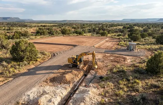
Coordinating the house pad, driveway, private well, septic area, and underground utility routes before construction can help reduce unnecessary trenching and disturbance on a rural Apache County property.
Ready to Plan Utility Trenching for Your Apache County Property?
Whether you're connecting a well to a homesite, extending electrical service, installing communications conduit, developing an off-grid property, or planning multiple underground utility routes, the excavation should be coordinated with the property's overall development plan.
Call to discuss your property, proposed utility routes, access conditions, and the excavation work needed to move the project forward.
Call (928) 543-6447Utility Trenching Through Rocky, Caliche & Difficult Ground in Apache County
Hard ground can be one of the biggest cost and production variables on a rural utility trenching project. In Apache County, a proposed trench may cross relatively workable soil for part of the route and then encounter cemented caliche, shallow rock, volcanic material, coarse rock, or dense native ground farther along the same alignment.
This matters because a trench is a narrow excavation that has to reach the required installation depth while maintaining enough working room for the planned utility. A route that appears easy from a driveway or property map can become substantially more involved when hard material is encountered below the surface.
Apache County also contains large rural properties where utilities may travel significant distances between a road, homesite, private well, solar equipment, workshop, or other improvement. On those longer runs, it is especially important to think about the actual ground conditions along the entire route rather than describing the property simply as “good dirt” or “rocky.”
For property owners requesting a trenching estimate, useful information includes the approximate route length, intended utility, proposed destination, known rock or caliche, existing driveway or road crossings, gate and access conditions, and whether the route has already been established by a site plan or utility professional. The more clearly the proposed corridor is understood, the easier it is to identify the excavation conditions that may affect the project.
Caliche & Cemented Ground
Caliche is not simply ordinary soil that happens to be dry. Cemented layers can become significantly harder to excavate than loose native material, particularly where the trench must pass continuously through the hardened zone.
The important questions are how deep the caliche begins, how thick or continuous the layer is, and whether it follows the entire proposed utility alignment. Those conditions can affect excavation production and the equipment or attachments needed for the work.
Volcanic & Shallow Rock
Parts of northeastern Arizona can contain rocky ground and volcanic material close to the surface. A trench may encounter isolated rocks in otherwise workable soil or a more persistent rocky zone that changes the excavation conditions for that portion of the route.
Rock encountered at trench elevation can affect production, spoil handling, equipment positioning, and the practical way a particular section of the alignment is excavated. Conditions should be evaluated along the proposed route rather than assumed from the appearance of the surrounding surface.
Excavation Method Matters
Not every difficult section of trench requires the same excavation approach. Equipment selection depends on the material encountered, trench dimensions, access, working room, route length, and the amount of hard material that actually has to be removed.
A practical trenching plan may therefore change from one portion of a rural route to another. Assuming the entire project will excavate at the same production rate can make a preliminary estimate less reliable when subsurface conditions are inconsistent.
Remote Access Can Change the Job
Hard excavation becomes more complicated when the trench is located far from an established road or construction area. Long ranch roads, steep approaches, narrow gates, soft sections, limited turning areas, and restricted staging locations can all affect how equipment reaches the work.
Before requesting a quote, it is useful to identify the actual equipment access route, not just the trench location. A trench may be easy to reach on paper but difficult to service efficiently if equipment cannot travel alongside the proposed alignment.
Long Rural Utility Runs
A utility route from a property entrance to a remote homesite, or from a well to a house pad, can extend far beyond the distances typical of an urban residential lot. Every additional section of trench adds excavation, equipment travel, spoil management, route coordination, and eventual restoration.
Long runs should also be evaluated for changes in terrain and ground conditions. One portion of the alignment may excavate normally while another encounters rock, caliche, a slope, an existing road, or another feature that requires additional planning.
Driveway & Road Crossings
Crossing an existing gravel driveway or rural access road is different from trenching through untouched ground. The excavation has to be coordinated with the existing road surface, traffic access, trench restoration, and the utility installation requirements.
If a driveway is still being planned, utility crossings are worth considering before the road base and finished surface are installed. Establishing the utility route first can prevent unnecessary cutting into newly completed access improvements.
Spoil Management Along the Trench
Excavated material has to go somewhere while the trench is open. On a long rural alignment, spoil may need to be managed progressively along the route rather than treated as one pile at the beginning of the project.
Rock, caliche, native soil, and other excavated materials may not all be equally useful for final backfill. The characteristics of the material and the requirements of the utility installation determine what can appropriately be reused and what may require different handling or supplemental material.
Backfill & Surface Restoration
The excavation is not finished simply because the utility has been placed in the trench. The disturbed corridor may need appropriate backfill, compaction, grading, and surface restoration based on what was excavated and what surface existed before construction.
Restoration becomes particularly important where the trench crosses a driveway, access road, building area, drainage feature, or previously improved portion of the property. The finished surface should be considered part of the overall excavation plan.
Route Planning Before Excavation
On undeveloped Apache County acreage, moving the proposed utility corridor a reasonable distance can sometimes change the excavation conditions it encounters. The route should therefore be considered in relation to existing grades, access roads, drainage, future buildings, septic areas, wells, and other utilities.
The shortest line is not automatically the least expensive line if it crosses difficult ground, requires additional crossings, creates poor equipment access, or conflicts with future improvements.
Information That Helps With a Trenching Quote
A useful preliminary estimate starts with a clear description of the project. Provide the approximate trench length, utility type, starting and ending locations, proposed route, known rock or caliche, driveway crossings, property access, and any available plans or utility requirements.
Photos of the proposed route, access entrance, existing roads, and known difficult areas can also help communicate conditions before an onsite evaluation. Final scope and pricing should be based on the actual route and project requirements.
Don't Price a Rocky Trench From Acreage Alone
The size of the property does not tell you how difficult the utility trench will be. A 20-acre parcel can have a relatively straightforward utility route, while a much smaller homesite can require difficult excavation if rock, caliche, steep terrain, limited access, or multiple crossings occur along the proposed alignment.
For a useful trenching estimate, the more important measurements are the actual route, utility type, required trench dimensions, ground conditions, equipment access, crossings, spoil requirements, and finished-surface restoration. Those factors describe the work that actually has to be performed.
If you are developing rural acreage in Apache County, identify the intended utility destinations before choosing the final trench alignment. A well, house pad, driveway, septic system, solar equipment, workshop, and future structures may all influence the route and can be considerably more expensive to relocate after construction is complete.
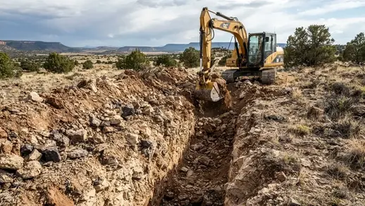
Rocky ground, caliche, volcanic material, and other dense subsurface conditions can change excavation production along a rural utility route and may require different equipment or excavation methods in difficult sections.
Long Rural Utility Runs Across Apache County Acreage
Long utility runs are common on rural Apache County properties where the homesite may be located well away from the property entrance, electrical service point, private well, communications connection, solar equipment, workshop, or other infrastructure. What looks like a simple connection on a property map can become a substantial excavation corridor once actual terrain, access, crossings, and ground conditions are considered.
On larger parcels, trench length is only one part of the project. The excavation crew also has to account for equipment movement, spoil placement, trench preparation, installation coordination, backfilling, compaction, and restoration along the entire disturbed corridor. A utility route extending several hundred feet across open acreage is a very different excavation project from a short trench serving a house on a small developed lot.
Apache County properties can also change significantly from one end of a route to the other. A trench may begin near an established road or driveway, cross undeveloped ground, encounter caliche or rock, pass through a slope or drainage area, and finally reach a remote building site. These changes can affect production, equipment access, trench alignment, spoil handling, and the practical sequence of the work.
Trench Length & Excavation Volume
The longer the route, the more excavation, material handling, backfilling, and restoration are involved. A 1,000-foot utility run can also require substantially more equipment travel and repositioning than a short connection near an existing building.
Changing Ground Conditions
Long rural routes should not be assumed to have uniform soil. One section may excavate normally while another encounters caliche, shallow rock, coarse material, or dense native ground. Difficult sections can change the excavation approach without affecting the entire route equally.
Equipment Access Along the Route
Remote trenching requires practical access for excavation equipment and support vehicles. Existing ranch roads, graded access routes, gates, steep approaches, soft areas, and limited turnaround space can influence how efficiently equipment can work along a long utility corridor.
Driveway & Road Crossings
A utility route may eventually cross an existing driveway, private road, or planned access route. Crossing locations should be identified before excavation so the trench, utility installation, backfill, and restoration can be coordinated with the property's access requirements.
Drainage & Terrain Changes
Rural utility corridors may pass through changing grades, drainage paths, low areas, or other portions of the property where surface-water movement matters. The trench alignment should be considered alongside existing drainage and planned site grading rather than treating the utility route as completely independent from the surrounding terrain.
Route Alignment & Future Development
The shortest route is not automatically the best route. A slightly different alignment may better serve the future house pad, well, septic area, workshop, solar equipment, driveway, or additional buildings while reducing future conflicts and repeated excavation.
Spoil Placement & Material Handling
Excavated material has to be managed as the trench progresses. On open acreage there may be room to place suitable spoil beside the route, but rock, unsuitable material, property constraints, drainage features, or finished improvements can limit where material can be safely or practically stockpiled.
Backfill & Surface Restoration
A long trench leaves a substantial disturbed corridor that must be addressed after the underground utility work is completed. Backfill, compaction, grading, and restoration requirements can vary depending on whether the trench crosses native ground, a driveway, an access road, or another prepared area.
Why Long Rural Trenching Should Be Priced From the Actual Route
A useful utility-trenching estimate needs more information than the approximate distance between two points. The actual route, utility type, required trench dimensions, ground conditions, equipment access, crossings, spoil handling, backfill requirements, and surface restoration all contribute to the excavation scope.
For example, a long water-line trench from a private well to a remote homesite may have completely different excavation conditions from a similarly long electrical route following an existing access road. Likewise, a route across open native ground can have a different scope from one that must cross a finished driveway or other completed improvement.
For Apache County property owners, the best starting point is therefore the actual utility corridor rather than a generic price per linear foot. Identifying the route, destinations, access conditions, crossings, and difficult sections early gives the excavation scope a much more useful foundation for estimating.
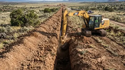
Long rural utility runs can extend hundreds or thousands of feet across Apache County acreage, requiring excavation access, route planning, spoil management, and restoration along the entire utility corridor.
Planning a Long Utility Run Across Apache County Acreage?
Whether you're connecting a private well to a remote homesite, extending electrical service to a rural structure, or establishing underground utilities across a large parcel, long trenching projects need to be evaluated from the actual route rather than a generic per-foot assumption.
Call (928) 543-6447Planning Rural Utility Corridors Across Apache County Acreage
A rural utility corridor is a planned pathway across the property where underground infrastructure can be installed and coordinated without repeatedly disturbing unrelated portions of the land. This becomes especially valuable on large Apache County parcels that will be developed in stages rather than improved all at once.
A property entrance, future house pad, private well, septic area, electrical service, solar equipment, workshop, cabin, livestock area, and other improvements may be separated by hundreds or even thousands of feet. On that type of property, utility planning should account for the entire development layout rather than simply drawing the shortest line between two connection points.
The best corridor is also not necessarily the straightest corridor. Existing access roads, driveway alignments, drainage features, slopes, gates, rocky ground, caliche, future building locations, and areas needed for septic or other infrastructure can all affect where an underground route makes practical sense.
1. Identify the Major Utility Destinations
Start with the locations that utilities may eventually need to serve: the property entrance, house pad, private well, septic area, electrical service point, solar equipment, workshop, cabin, gate equipment, livestock facilities, and other planned improvements. Thinking beyond the first structure can prevent an early trench from becoming an obstacle to later development.
2. Establish Practical Utility Alignments
The shortest distance is not automatically the most practical trench alignment. On Apache County acreage, the route may need to work around steep ground, drainage paths, rocky areas, existing improvements, property access, or locations reserved for future construction. A slightly longer alignment can sometimes avoid substantially more difficult excavation or future conflicts.
3. Coordinate With Driveways & Access Roads
Private driveways and rural access roads frequently intersect utility routes. Planning those crossings before final road construction can reduce the need to cut through newly placed gravel, road base, drainage improvements, or compacted access surfaces. Utility crossings should be identified before the road becomes finished infrastructure.
4. Coordinate Well & Septic Locations
A rural homesite often has infrastructure distributed around the building area rather than concentrated in one location. Water lines may originate at a private well while septic components occupy a different portion of the property. Utility routes should be planned around the approved locations and applicable separation, setback, and access requirements for those systems.
5. Coordinate Multiple Underground Utilities
Electrical, water, communications, and other underground systems may ultimately serve the same building area. Their individual burial requirements, separation, crossings, easements, and installation specifications need to be considered before excavation. Coordinating the routes early can prevent one utility installation from interfering with another.
6. Reserve Routes for Future Improvements
Rural Apache County properties are frequently developed over time. A property owner may begin with a house and well and later add a workshop, detached garage, cabin, agricultural structure, additional communications equipment, or other improvement. A corridor planned with those likely additions in mind can reduce future excavation across completed portions of the property.
7. Account for Apache County Ground Conditions
A utility alignment can cross several different excavation conditions on the same parcel. Depending on location, portions of a route may encounter caliche, shallow or volcanic rock, coarse native material, slopes, drainage features, or difficult equipment access. The corridor should be evaluated according to the actual route rather than assuming uniform ground conditions across the property.
8. Plan Equipment Access & Spoil Handling
Long rural trenches require more than an excavation machine at the starting point. Equipment needs practical access along the alignment, while excavated material needs somewhere to be placed without blocking the trench, driveway, drainage path, or property access. Gates, narrow approaches, slopes, and remote locations can become important logistical considerations.
9. Identify Crossings & Conflict Areas
Utility routes may cross driveways, access roads, drainage features, existing utilities, property improvements, or other infrastructure. Identifying these locations before excavation allows the installation sequence and restoration requirements to be considered instead of discovering conflicts after the trench is already open.
10. Consider Future Expansion
A corridor does not have to be designed only around today's utility demand. Where future expansion is reasonably foreseeable, property owners can discuss additional conduit, spare pathways, or other provisions with the appropriate utility or installation professionals before the trench is closed.
11. Plan Backfill & Surface Restoration
The trench is only part of the completed excavation project. Backfill, compaction, grading, and surface restoration may become particularly important where the corridor crosses a driveway, road, drainage feature, building area, or other previously prepared portion of the property.
12. Confirm Project Requirements Before Excavation
Utility routes can involve requirements from the utility provider, applicable authorities, property easements, project plans, inspections, and the specific utility being installed. Confirming those requirements before trenching helps establish the excavation scope and reduces the risk of having to modify an already completed underground route.
Think About the Property as a Connected System
A useful utility corridor does more than connect Point A to Point B. It establishes an underground infrastructure strategy that works with the house pad, driveway, well, septic system, electrical service, communications, solar equipment, access roads, drainage, and future structures.
This matters particularly on larger Apache County properties where infrastructure may be spread across substantial acreage. Planning the major relationships before excavation can reduce repeated trenching, protect completed improvements, and make later phases of rural development easier to execute.
For a property that is still largely undeveloped, the utility corridor can be one of the most useful pieces of the overall site-development plan because it establishes where underground infrastructure can travel before driveways, pads, buildings, landscaping, and other improvements make those routes more difficult to reach.
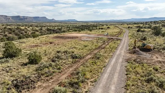
Rural utility corridors should be planned around the property's house pad, access roads, well, septic area, future structures, drainage, and other infrastructure rather than simply following the shortest route between two points.
Need a Utility Trench Through Rocky or Caliche Ground?
If your Apache County property has known rock, caliche, volcanic material, difficult access, or other challenging excavation conditions, the actual trench route can make a significant difference in the project scope. Call to discuss the proposed utility route, access conditions, and known ground conditions.
Call (928) 543-6447Utility Separation and Coordination Before Trenching
Rural properties frequently need several underground systems serving the same general development area. Electrical service, water lines, communications conduit, septic infrastructure, drainage features, and future utility routes may all compete for usable space around a rural homesite.
Those systems should not simply be installed wherever open ground happens to be available. The route for each utility needs to be considered in relation to the others, including applicable separation requirements, crossings, burial depths, easements, access, existing improvements, and future construction.
This coordination becomes especially important on Apache County properties where a remote house pad may have a private well on one side, septic infrastructure on another, a long driveway approaching from the property entrance, and electrical or communications service traveling across the parcel. Good planning keeps one underground installation from creating a problem for the next one.
1. Map the Underground Infrastructure
Identify the proposed locations of electrical service, water lines, communications conduit, septic-related infrastructure, drainage improvements, and other buried systems before trenching begins. Showing these routes together makes potential conflicts much easier to identify than planning each utility independently.
2. Establish Required Separation
Different utilities can have different separation and installation requirements. The required spacing depends on the particular systems being installed and the applicable codes, standards, utility-provider requirements, and project plans. Separation should therefore be established before the excavation layout is finalized.
3. Plan Utility Crossings
Water, electrical, communications, and other underground routes may need to cross one another or intersect an existing driveway or access road. Crossings should be identified during planning so depth, separation, installation sequence, and restoration requirements can be coordinated before the trench is open.
4. Coordinate With Driveways & Roads
A utility route that crosses a finished rural driveway or access road can turn a relatively simple installation into additional road excavation and restoration. Where possible, utility crossings should be identified while the driveway and its drainage features are still being planned rather than after the access route has been completed.
5. Protect Future Building Areas
Underground routes should account for future house pads, workshops, garages, cabins, barns, and other improvements. A utility installed through an area later needed for construction can create unnecessary conflicts, especially on rural properties being developed in phases.
6. Allow for Future Utility Expansion
The first trench may not be the last underground installation on a rural property. Future buildings, communications equipment, electrical upgrades, water extensions, or other improvements may require additional routes. Where expansion is foreseeable, the property owner can discuss future pathways or spare conduit with the appropriate utility and installation professionals before the corridor is closed.
Do Not Assume Multiple Utilities Can Simply Share One Trench
Electrical, water, communications, and other underground systems do not automatically have the same burial, separation, conduit, crossing, or installation requirements. Whether utilities can share a trench or corridor depends on the specific systems, applicable requirements, and installation design.
The excavation contractor can prepare the trench according to an established installation plan, but the utility layout should be coordinated with the professionals responsible for the individual systems. This is particularly important where electrical service, potable water, communications, and other buried infrastructure converge near a rural homesite.
On larger Apache County parcels, good coordination can also reduce unnecessary excavation. A well-planned underground corridor can provide predictable routes between the property entrance, house pad, well, septic area, outbuildings, and future improvements instead of repeatedly disturbing the same ground every time another utility is added.
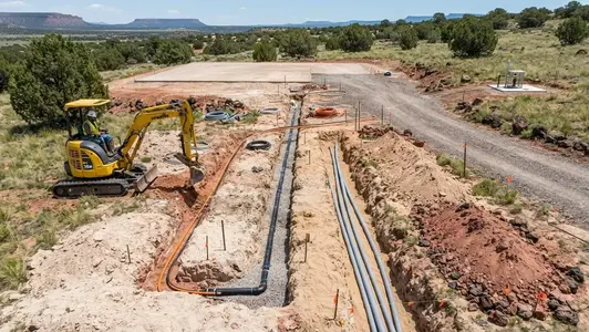
Multiple underground systems serving a rural homesite should be coordinated before trenching so utility routes, crossings, separation, access, and future construction requirements can be considered together.
Utility Trench Backfilling, Compaction & Surface Restoration
Excavating the trench is only one stage of a utility project. After the underground installation is completed, the disturbed corridor has to be backfilled and restored in a way that works with the property's intended use. On rural Apache County acreage, that may mean restoring an unimproved utility corridor, a gravel driveway, an access road, a graded homesite, or ground that must continue to handle stormwater.
The material removed during excavation is not automatically suitable for every part of the backfill. Rock, oversized material, organic material, loose soil, caliche, and other excavated material may have different characteristics. The appropriate backfill and compaction approach depends on the utility installation, trench location, surface use, project specifications, and the material actually encountered during excavation.
Restoration also needs to account for what the trench crosses. A utility installed through open native ground has different restoration considerations from one crossing a finished gravel driveway or an area that has already been graded for construction. The objective is not simply to make the trench disappear; the restored corridor should remain compatible with the property's access, drainage, and future development.
Backfill Material Selection
Excavated material should be evaluated before it is placed back into the trench. Depending on the project, some native material may be suitable for reuse while other material may need to be screened, removed, supplemented, or replaced with specified fill. This becomes particularly relevant where excavation encounters rock, caliche, or other difficult native material.
Controlled Backfill & Compaction
Backfill placement and compaction should reflect the requirements of the particular installation and the surface above the trench. A utility corridor beneath an open portion of acreage is different from one beneath a driveway, parking area, or future building-related surface where settlement could create a much more significant problem.
Gravel Driveway Restoration
Utility trenches crossing Apache County gravel driveways can disturb the compacted road base and finished driving surface. Restoration may require replacing suitable aggregate, rebuilding the disturbed section, grading the surface, and reconnecting the repaired area to the existing driveway so the crossing does not become a persistent rut or depression.
Drainage & Runoff Restoration
A trench can unintentionally become a low channel or raised berm if the restored surface does not match the surrounding grades. On Apache County properties, monsoon runoff can expose poorly restored areas quickly. Final grading should consider existing drainage patterns and avoid creating an unintended path for concentrated water.
Rocky Spoil & Difficult Material
Long rural trenches may generate excavated rock, coarse material, or hardened caliche that cannot simply be treated the same as loose native soil. Managing oversized or unsuitable spoil can affect backfill operations, material hauling, grading, and the amount of suitable material available for restoring the corridor.
Restoration for Future Development
Some trenches cross areas that will later become driveways, parking areas, building approaches, or additional construction zones. Restoration should consider the property's next phase rather than treating the disturbed ground as permanently finished when additional grading or construction is already planned.
The Trench Is Not Finished When the Pipe or Conduit Goes In
One of the most common concerns with rural utility excavation is what happens after the underground line is installed. A poorly restored trench can settle, collect runoff, rut under vehicle traffic, or become an obstacle when the property is developed further.
This is particularly important when a utility crosses a gravel driveway or private access road. The disturbed section needs to be considered as part of the road rather than simply as an excavation that happens to cross it. Likewise, a trench crossing previously graded property should be restored with the surrounding grades and future site work in mind.
For long Apache County utility runs, the excavation scope should therefore account for both ends of the project: getting the trench excavated and installed correctly, and returning the disturbed corridor to a condition that works with the property's next stage of development.
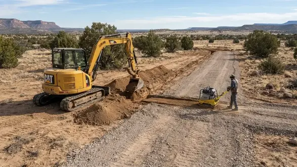
Utility trench completion includes appropriate backfill, compaction, grading, and surface restoration so the disturbed corridor remains compatible with roads, drainage, access, and future property development.
811 Utility Location Before Excavating in Apache County
Utility locating should be addressed before excavation begins, even on remote or undeveloped Apache County property. A parcel that appears completely untouched from the surface may still contain buried electrical service, communications lines, water piping, irrigation systems, or other underground infrastructure.
Arizona's 811 system is intended to help identify underground utility facilities that participating utility operators have in their records and responsibility. Calling 811 before digging is an important part of planning a trench, but property owners should understand what an 811 locate does and does not identify before excavation equipment arrives.
Rural properties deserve additional attention because privately installed infrastructure can extend well beyond the obvious building area. A water line from a private well, electrical service to an outbuilding, irrigation piping, communications cable, or other owner-installed utility may not be located through the standard public utility locate process.
Before trench excavation, consider the following:
-
Contact Arizona 811 Before Digging
Submit the required utility-location request before excavation begins and allow the applicable utilities the required time to respond and mark facilities within the locate area. Do not begin digging simply because a property appears vacant or remote. -
Identify the Entire Proposed Trench Alignment
Utility locating should correspond to the actual area where excavation will occur. On a long rural trench, the route may extend from a property entrance to a distant house pad, well, workshop, or other improvement. The excavation alignment should be established before equipment begins moving along the corridor. -
Do Not Assume Private Utilities Are Covered
Privately owned underground facilities may fall outside the standard utility-locate responsibility. Water lines from private wells, private electrical lines between buildings, irrigation piping, private communications infrastructure, and other owner-installed systems may require separate locating. -
Check Existing Improvements & Utility Records
Property owners should identify known wells, electrical services, septic-related infrastructure, previous construction, outbuildings, buried lines, easements, and other improvements that could affect the proposed excavation. Existing plans, property records, previous contractors, and utility providers may provide useful information about known infrastructure. -
Pay Attention to Crossings
Driveways, private roads, existing utility corridors, drainage improvements, building areas, and other developed portions of the property can contain buried infrastructure. A proposed trench should be reviewed carefully wherever it crosses or approaches existing improvements. -
Marks Do Not Eliminate Excavation Responsibility
Utility marks indicate identified facilities and their approximate locations; they should not be treated as permission to excavate without regard to the applicable excavation requirements. The excavation approach should account for the actual conditions encountered and the requirements associated with the identified facility. -
Consider Private Utility Locating When Appropriate
If privately owned underground infrastructure is known or suspected, a separate private locating service may be appropriate before excavation. This can be especially important on rural properties with private wells, multiple buildings, irrigation systems, detached electrical service, or utilities installed by previous owners. -
Recheck the Route Before Equipment Starts Digging
Before excavation begins, the planned trench alignment, utility markings, known private facilities, access points, and other potential conflicts should be reviewed. This final check is particularly useful on long rural utility runs where the trench may cross several different areas of the property.
811 Does Not Mean Every Buried Line Has Been Located
One of the most important distinctions for rural property owners is the difference between public utility facilities and privately owned underground infrastructure. An 811 request is an essential pre-excavation step, but it should not be treated as a guarantee that every buried line on private property has been identified.
For example, a private well may have a buried water line running hundreds of feet toward a house pad, or an existing outbuilding may have a private electrical or communications connection that is not part of a utility operator's locate responsibility. Those facilities may require additional investigation or private locating before excavation.
On large Apache County acreage, this distinction becomes especially important because underground infrastructure can extend well beyond the immediate building area. Before trenching, the safest approach is to combine the applicable 811 process with what the property owner already knows about the parcel and any additional locating needed for privately owned facilities.
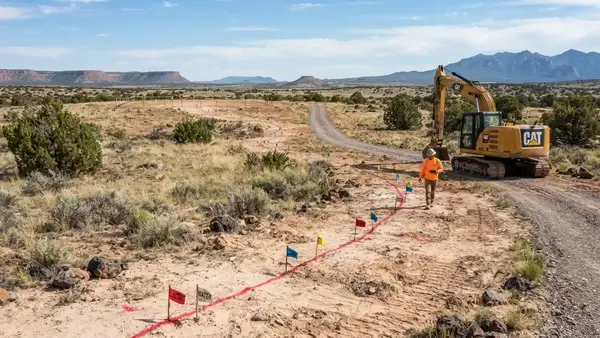
Utility locating should be completed before excavation, with the proposed trench alignment reviewed against marked facilities and known private underground infrastructure on the property.
Have Your Utility Route Planned? Let's Discuss the Excavation
Once applicable utility locating and project requirements have been addressed, the next step is understanding the actual excavation corridor. We can discuss trench length, access conditions, crossings, rocky or caliche ground, and the restoration requirements for your Apache County property.
Call (928) 543-6447Utility Trenching Permits, Approvals & Inspections in Apache County
Digging a trench and installing a utility are not necessarily the same scope of work. Before trenching begins on rural Apache County property, the project should be reviewed to determine which utility-provider requirements, permits, inspections, easements, right-of-way approvals, or other authorizations may apply to the proposed route.
Requirements can change depending on what is being installed and where the trench will run. An underground electrical service, private water line, communications conduit, septic-related work, or utility crossing may involve different authorities and installation requirements. A route entirely on private property can also have different requirements from one that approaches or crosses a public road, right-of-way, easement, or other controlled area.
For rural development, it is usually better to identify these requirements before the excavator arrives. Discovering after excavation begins that a route needs to be changed, inspected, permitted, or coordinated with another authority can create unnecessary rework and additional disturbance.
1. Identify the Utility Being Installed
Start by identifying exactly what the trench will serve: electrical service, water, communications, conduit, or another underground system. Each type of utility can have its own installation specifications, approval process, inspection requirements, and responsible authority.
2. Determine the Applicable Authority
The responsible authority may depend on the property location, utility type, service provider, and proposed route. Apache County requirements may apply to certain work, while a utility provider, state agency, health authority, or other jurisdiction may have separate requirements for the installation.
3. Check Roads & Rights-of-Way
A trench that approaches or crosses a public road, right-of-way, or other controlled corridor may require additional authorization. Do not assume that permission to work on private property automatically authorizes excavation within a public or controlled area.
4. Review Easements & Property Boundaries
Utility routes may involve recorded easements or cross areas that are not entirely under the property owner's control. Before excavation, the proposed alignment should be checked against the property's boundaries, known easements, access agreements, and other applicable property restrictions.
5. Confirm Project Approvals
Determine whether the planned installation requires permits, utility-provider approval, engineering, plans, or other documentation before excavation. Requirements should be confirmed for the actual project rather than assuming that every rural trench follows the same approval process.
6. Coordinate Utility Requirements
Electrical, water, communications, septic-related infrastructure, and other systems can have different burial, separation, crossing, material, and installation requirements. Those requirements should be established before the trench alignment and excavation scope are finalized.
7. Plan Required Inspections
Some installations require inspection before portions of the work are covered. Inspection requirements should be identified in advance so the trench is not backfilled before the responsible authority or utility provider has completed any required inspection.
8. Coordinate Excavation With Installation
Once the applicable requirements are understood, trench excavation can be coordinated with the utility installer and the planned installation. This helps ensure the trench location, dimensions, access, crossings, and restoration approach are compatible with the actual utility project.
Verify Requirements Before the Excavator Starts Digging
A trench can be physically ready for a utility without the overall utility installation being approved or ready to proceed. Before excavation, confirm the requirements that apply to the specific property, utility, route, and jurisdiction.
This is especially important on larger Apache County properties where a trench may extend across substantial distances, approach a public road, cross an easement, pass through multiple site improvements, or connect several separately permitted systems. Resolving those requirements early can help prevent having to move or reopen a completed trench later.
What Apache County Property Owners Should Know Before Utility Trenching
The most expensive trenching mistakes are often planning mistakes rather than excavation mistakes. Before bringing an excavator onto rural property, establish where the major infrastructure needs to go and how those systems will interact with one another.
This is especially important on larger Apache County parcels where the house pad, driveway, private well, septic area, electrical service, solar equipment, outbuildings, and other improvements may be separated by considerable distances. A utility route that looks straightforward on a property map can become much more complicated once terrain, access, drainage, existing improvements, and future development are considered.
Before trench excavation begins, consider the following:
-
Identify the Final Building Area
Establish the intended house pad, cabin, manufactured home, workshop, or other primary building location before determining permanent utility routes. Moving the building location later can affect water, electrical, communications, driveway, septic, drainage, and other site plans. -
Establish the Access Route
Excavation equipment needs a practical way to reach the trench and move along the property. Existing ranch roads, private driveways, gates, slopes, narrow approaches, turning areas, and available staging space can all affect how the work is performed. -
Locate the Well & Water System
If the property will use a private well, establish the well location and intended points of use before determining the water-line route. The relationship between the well, house pad, outbuildings, access, and future improvements can affect the most practical trench alignment. -
Establish the Septic Area
The approved septic layout should be considered before permanent utility routes are excavated. Keeping the house pad, wastewater system, water infrastructure, driveway, and underground utilities coordinated can help prevent unnecessary conflicts and re-excavation later. -
Determine the Electrical Connection
Identify the intended service point, electrical equipment, or approved power source before establishing the underground electrical route. The route should also be considered in relation to the driveway, building area, other utilities, property access, and future improvements. -
Plan Communications & Data
If internet, data, security, gate controls, monitoring equipment, or other communications infrastructure will be needed, determine where conduit should begin and terminate before excavation. Planning these pathways early can avoid cutting through completed driveways or other finished improvements later. -
Plan Solar & Off-Grid Equipment
Off-grid properties may have solar arrays, batteries, inverters, generators, or other equipment located separately from the residence. Establishing these locations before trenching helps determine where underground electrical pathways need to run and allows room for planned future expansion. -
Address Existing Underground Utilities
Contact 811 and follow the applicable Arizona utility-location process before covered excavation. Rural or undeveloped property should not automatically be assumed to be free of buried infrastructure. Privately owned underground facilities may require separate locating arrangements. -
Choose the Practical Trench Alignment
The shortest route is not always the best route. Existing roads, slopes, drainage and site grades, difficult ground, gates, future structures, utility crossings, easements, and equipment access can make a slightly longer alignment more practical and less disruptive. -
Confirm Project Requirements
Before excavation, determine which permits, inspections, utility-provider requirements, easements, engineering, right-of-way approvals, or other project-specific requirements apply. Excavating the trench does not automatically authorize the utility installation or connection.
Do Not Dig the Trench Before You Know Where Everything Else Goes
On rural acreage, utility trenching is connected to nearly every major site-development decision. A driveway may cross the utility route. The well may determine the water-line direction. The septic layout may restrict where infrastructure can be placed. The house pad determines the final destination, while future workshops, cabins, solar equipment, or other improvements may create additional utility needs.
Establishing these relationships before excavation gives the trench a purpose beyond simply connecting two points. It helps create a utility layout that works with the property's existing terrain and the way the owner intends to develop the Apache County property.
Why Apache County Ground Conditions Matter for Utility Trenching
Utility trenching conditions can change significantly across Apache County. A rural utility route may cross open high-desert ground, rocky terrain, caliche, slopes, drainage features, or areas where equipment access is limited. Even on the same property, excavation conditions can change substantially from the entrance to the homesite.
This matters when estimating the actual excavation work. A trench that is straightforward through workable native material can become considerably more demanding when the alignment encounters shallow rock, cemented caliche, coarse material, steep terrain, or restricted equipment access. Long rural runs should therefore be evaluated according to the actual route rather than assuming uniform ground conditions across the property.
Seasonal conditions can also affect rural trenching. Summer monsoon storms can temporarily change drainage, access, and ground conditions, while higher-elevation portions of Apache County can experience snow, freezing temperatures, and winter access challenges. These conditions do not automatically prevent excavation, but they can affect scheduling, equipment access, spoil handling, and restoration.
Rocky & Volcanic Ground
Rock and volcanic material can occur along otherwise practical utility routes. Shallow rock may slow trench production, require different excavation equipment or attachments, and create additional material-handling considerations. Conditions can change over relatively short distances, so finding rock in one portion of a property does not necessarily mean the entire route has the same conditions.
Caliche & Dense Subsurface Material
Cemented or hardened caliche can excavate very differently from loose native soil. The depth, thickness, and continuity of dense material can affect excavation production, equipment selection, trench working conditions, and the amount of material that can reasonably be reused during restoration.
Monsoon Runoff & Drainage
Summer monsoon storms can produce concentrated runoff across rural properties. Utility routes that cross slopes, washes, drainage paths, or low areas should be considered carefully so excavation and restoration do not unintentionally create a new path for water or leave a trench corridor vulnerable to erosion.
Slopes & Changing Elevations
A rural trench may travel across changing elevations between the property entrance, well, house pad, and other improvements. Slopes can affect equipment positioning, access, trench alignment, drainage, and the practical relationship between the underground utility and the surrounding site grades.
Remote Equipment Access
Remote Apache County acreage may require equipment to travel substantial distances along private roads or undeveloped access routes before reaching the trench. Gates, narrow approaches, steep sections, rough roads, limited turning space, and restricted staging areas can all affect excavation logistics.
Conditions Can Change Along One Route
A long utility run should not be treated as though every section will excavate at the same production rate. One portion may pass through workable soil while another encounters rock, caliche, drainage, or difficult access. Evaluating the actual trench alignment helps identify where excavation conditions may change and where additional planning may be needed.
The Property Map Does Not Tell You Everything About the Trench
Aerial imagery can show the general terrain, roads, vegetation, slopes, and existing improvements, but it cannot reliably reveal every subsurface condition at the depth of a proposed utility trench. Actual excavation conditions can vary even within the same parcel.
For a high-intent utility trenching project, the useful questions are where the trench will run, how far it extends, how equipment will reach the route, what surface and subsurface conditions may be encountered, and how the disturbed corridor will be restored afterward. Those factors provide a much more useful basis for planning than simply labeling a property as "rocky" or "easy to dig."
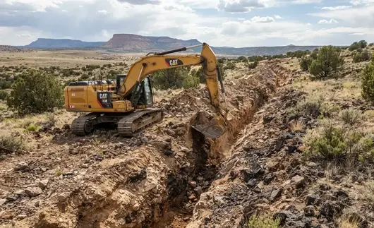
Utility trench conditions can change across Apache County acreage, with excavation routes potentially encountering workable native soil, dense caliche, rock, changing grades, drainage areas, and difficult equipment access.
Utility Trenching Cost in Apache County: What Property Owners Should Expect
Utility trenching costs in Apache County depend on much more than the length of the proposed trench. Every rural property has different soil and rock conditions, terrain, access limitations, utility requirements, trench depth, spoil-handling needs, and restoration requirements. A relatively short trench through accessible native soil can be much less involved than a longer route through rocky ground, caliche, steep terrain, or remote acreage.
We evaluate utility trenching based on the actual excavation required for the proposed route. The goal is to establish a practical underground pathway that works with the property's existing grades, drainage, access, homesite, driveway, well, septic system, solar equipment, and other planned improvements.
Typical Utility Trenching Investment Factors
Short Utility Trenching Runs
Typically $2,000 – $5,000+
Shorter trenching projects with relatively straightforward access and manageable ground conditions may involve excavation for a single electrical conduit, water line, communications route, or similar underground utility. Actual cost depends on trench depth, width, soil conditions, access, utility requirements, and restoration.
Longer Rural Utility Routes
$5,000 – $15,000+
Longer utility routes connecting a rural homesite with a well, electrical service point, outbuilding, workshop, cabin, or other improvement generally require more excavation, equipment time, spoil handling, and surface restoration. Route length, terrain, and access can have a major effect on the total project investment.
Rocky, Caliche & Difficult Ground
Custom Quote
Apache County properties can contain caliche, volcanic rock, shallow rock, dense ground, and other difficult excavation conditions. Hard material may require ripping, breaking, heavier equipment, additional excavation time, or specialized attachments, depending on the depth and extent of the material encountered.
Electrical & Communications Trenches
Varies By Route & Requirements
Underground electrical service and communications routes can vary significantly based on trench length, required depth, conduit configuration, crossings, terrain, access, and the conditions of the property. Excavation should be coordinated with the final utility layout and applicable installation requirements.
Water Line & Well Connection Trenches
Varies By Site Conditions
Rural properties with private wells may require underground trenches between the well system and a home, cabin, shop, livestock facility, or other structure. Route length, terrain, trench depth, rock, access, crossings, and the relationship to driveways, septic areas, and building pads can all affect the excavation requirements.
Remote Properties & Difficult Equipment Access
Custom Quote
Remote Apache County acreage can involve long access routes, narrow gates, rough roads, steep approaches, limited staging areas, or difficult terrain. Equipment mobilization, spoil placement, turning space, and restricted access can increase the time required to complete the trenching project.
Why Utility Trenching Pricing Requires a Property-Specific Estimate
Two Apache County properties requiring the same type of utility can have dramatically different trenching costs. One route may pass through accessible native soil with a short excavation distance, while another may cross rocky terrain, caliche, slopes, existing driveways, drainage areas, or remote portions of the property.
For that reason, utility trenching should not be priced solely by trench length or a generic price per foot. The proposed utility route, required depth, ground conditions, access, excavation volume, spoil handling, backfill requirements, and surface restoration provide a much more useful basis for estimating the project.
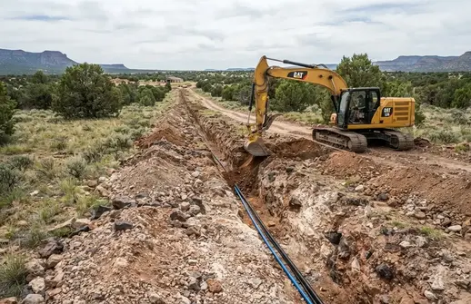
Utility trenching costs can increase when underground routes require greater excavation depth, difficult ground, longer equipment access, rock or caliche excavation, spoil handling, backfill, and restoration across a rural Apache County property.
Get a Property-Specific Utility Trenching Estimate
Utility trenching costs depend on the actual route, trench dimensions, ground conditions, equipment access, crossings, spoil handling, backfill, and surface restoration. Tell us where the utility needs to run and what you already know about the property so the excavation scope can be evaluated more accurately.
Call (928) 543-6447What Affects Utility Trenching Cost in Apache County?
Utility trenching cannot be accurately priced from trench length alone. The biggest cost differences usually come from how much excavation is required, what the ground is like, how difficult the property is to access, what utility is being installed, and how the disturbed area must be restored after the underground work is completed.
Trench Length & Excavation Volume
Longer utility routes naturally require more excavation, equipment time, spoil handling, and restoration. Trench depth and width also affect the total amount of material that must be removed and managed during the project.
Required Trench Depth
Required excavation depth depends on the utility, installation method, applicable requirements, crossings, terrain, and project specifications. Deeper excavation can require additional equipment time, working space, spoil handling, and safety considerations.
Rock, Caliche & Hard Ground
Shallow rock, volcanic rock, caliche, and dense subsurface material can significantly increase trench excavation time. The depth, distribution, and hardness of difficult material all affect the equipment and excavation methods required.
Equipment Access & Mobilization
Remote acreage may require longer equipment travel, difficult approaches, narrow gates, rough access roads, additional staging, or careful equipment positioning. Limited access can increase mobilization and reduce excavation efficiency.
Spoil Handling & Backfill
Excavated material must be managed appropriately during trench construction. Project requirements may involve keeping suitable material onsite, moving spoil away from the excavation, placing approved backfill, compacting the trench, and restoring the disturbed surface.
Drainage, Crossings & Surface Restoration
Utility routes crossing drainage areas, slopes, driveways, existing grades, or other improvements may require additional planning and excavation. After installation, disturbed areas may need grading or restoration so the completed route integrates properly with the surrounding property.
Why a Property-Specific Utility Trenching Estimate Matters
Two utility trenches with the same approximate length can have dramatically different excavation costs. One may pass through accessible native soil with simple equipment access, while another may encounter rock, caliche, steep terrain, drainage crossings, difficult access, or a long route across undeveloped acreage.
The useful starting point is therefore the actual property and proposed utility route, not simply a generic price per foot. Trench length, depth, utility type, ground conditions, access, spoil handling, backfill, and restoration requirements provide a much better basis for estimating the project.
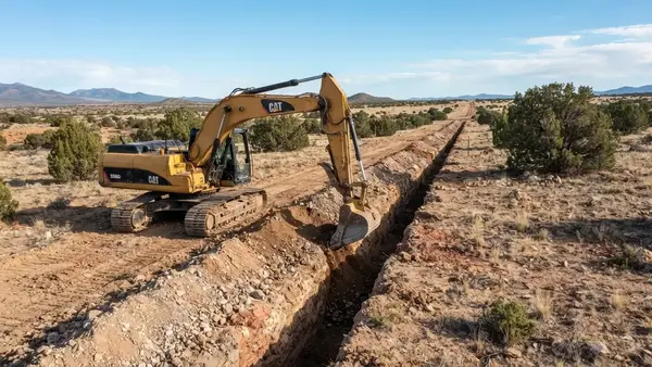
Utility trenching costs can vary significantly with trench length, excavation depth, rocky or caliche-rich ground, equipment access, spoil handling, backfill requirements, and the amount of surface restoration required after underground installation.
Utility Trenching Service Area
We provide utility trenching and underground utility excavation throughout Apache County, Arizona. Our work supports homeowners, ranchers, cabin owners, agricultural users, developers, and off-grid landowners with electrical service trenches, water line trenches, communications conduit routes, underground utility corridors, and other rural infrastructure excavation. Utility routes can be coordinated with homesites, building pads, wells, septic systems, driveways, solar equipment, workshops, cabins, and other planned property improvements.
- St. Johns, AZ
- Springerville, AZ
- Eagar, AZ
- Concho, AZ
- Vernon, AZ
- Sanders, AZ
- Alpine, AZ
- Nutrioso, AZ
- Greer, AZ
- McNary, AZ
- Ganado, AZ
- Window Rock, AZ
- Adamana, AZ
- Chambers, AZ
- Houck, AZ
- Lupton, AZ
- Many Farms, AZ
- Rock Point, AZ
- Round Rock, AZ
- Wide Ruins, AZ
- Surrounding Rural Communities
If your property is located anywhere in Apache County or the surrounding rural communities, we can help evaluate the excavation requirements for your proposed utility route. Trenching projects are planned around the property's terrain, access, soil and rock conditions, drainage patterns, proposed utility location, and future development. This is particularly important on remote and off-grid properties where electrical, water, communications, and other underground routes may need to cross undeveloped or difficult terrain.
Utility Trenching FAQs
Utility trenching on rural property in Apache County requires more than simply digging a narrow trench and covering it back up. Ground conditions, utility type, trench alignment, access, existing grades, drainage, rocky or caliche-rich soils, and the location of future homes, wells, septic systems, driveways, and solar equipment can all affect the excavation. The answers below address common questions about underground utility excavation and rural property development throughout Apache County, Arizona.
- What is utility trenching?
- Utility trenching is the excavation of a narrow, controlled excavation used to install or prepare for underground utility lines, conduit, piping, or other infrastructure. Depending on the project, trenching may be used for electrical service, water lines, communications conduit, utility conduits, septic-related components, or other underground services. The trench alignment, excavation dimensions, material handling, and backfill approach depend on the utility being installed and the specific conditions of the property.
- What types of utility trenches can you excavate in Apache County?
- Utility trench excavation can support a variety of rural property improvements, including electrical service routes, underground electrical conduit, water lines from wells or other sources, communications conduit, utility connections, and certain septic-related excavation. Off-grid properties may also require multiple underground routes connecting a homesite with a well, septic area, solar equipment, outbuildings, workshop, cabin, or other improvements. The excavation method depends on the utility, route, ground conditions, and project requirements.
- Can you trench for electrical service on rural or off-grid property?
- Yes. Underground electrical routes are common on rural and off-grid properties where power needs to travel from a service point, electrical equipment, or other approved connection location to a home, cabin, workshop, outbuilding, or other structure. Trenching provides the excavated pathway for the electrical installation. Required conduit, wiring, depth, separation, inspection, connection, and electrical work must follow the applicable project requirements and be completed by the appropriate qualified or licensed professionals where required.
- Can you trench for water lines from a well to a house or other building?
- Yes. Rural properties with private wells may require underground trenches to route water from the well system toward a home, cabin, shop, livestock facility, or other structure. The trench route should be considered alongside the property's existing grades, driveway, building pad, septic area, and other planned improvements. Water-line sizing, burial requirements, connections, pressure systems, and related plumbing requirements depend on the specific installation and should be coordinated with the appropriate well and plumbing professionals.
- Can you excavate trenches for septic system components?
- Utility and site excavation may be used for portions of a septic project, including appropriate trenching or excavation associated with approved septic system layouts. However, septic systems have specific design, permitting, setback, soil, installation, and inspection requirements. The septic system itself should be designed and installed according to the applicable Arizona and local requirements by the appropriate qualified professionals. Excavation can then be coordinated with the approved project layout.
- Can you trench for underground conduit, communications, or other utilities?
- Underground conduit and communications routes can be excavated for rural homes, cabins, workshops, ranch improvements, and other structures. Depending on the property, a trench may carry communications conduit, electrical conduit, control wiring pathways, or other underground infrastructure. Utility separation, conduit specifications, burial depth, crossings, and installation requirements vary by the utility and project, so excavation should be coordinated with the final utility layout.
- How deep should utility trenches be in Apache County?
- There is no single trench depth that applies to every utility project. Required depth can depend on the type of utility, installation method, applicable codes or standards, location, crossings, soil conditions, frost or environmental considerations, and the requirements of the utility provider or project authority. The excavation should be established to the depth required for the specific installation rather than assuming that every utility can be buried at the same depth.
- How wide does a utility trench need to be?
- Trench width depends on what is being installed, the depth of excavation, the equipment being used, soil conditions, required working space, and applicable installation or safety requirements. A narrow trench for a simple underground line may have very different requirements from a deeper excavation containing multiple utilities or requiring additional working room. The trench should be excavated to accommodate the planned installation without creating unnecessary disturbance.
- Can you trench through rocky ground, caliche, or volcanic rock in Apache County?
- Many Apache County properties contain hard ground, caliche, volcanic rock, coarse rock, and other difficult excavation conditions. These materials can slow trench excavation and may require heavier equipment, ripping, breaking, excavation attachments, or additional handling depending on the depth and extent of the material. Rocky conditions can also affect trench alignment and spoil management, so the excavation approach should be based on the actual ground encountered along the proposed utility route.
- Can utility trenches be installed on sloped or uneven rural property?
- Yes. Utility routes can often be excavated across sloped or uneven rural terrain, but the route needs to account for existing elevations, changes in grade, drainage, access, and the requirements of the utility being installed. On larger Apache County parcels, the most direct route is not always the most practical route. Coordinating the trench with the future homesite, driveway, well, septic system, solar equipment, and other improvements can help reduce unnecessary excavation and future disturbance.
- How do you handle drainage and runoff around utility trenches?
- Drainage should be considered before excavating a utility route, particularly on sloped rural property. An improperly located trench can alter the way surface water moves across the site or create a pathway for concentrated runoff. Apache County properties can also experience intense summer monsoon storms. Trench alignment, surrounding grades, crossings, backfill, and surface restoration should therefore be considered together so the completed utility route does not unnecessarily interfere with existing drainage patterns.
- Can utility trenching be coordinated with house pads, driveways, wells, septic, and solar?
- Yes, and coordination can be especially valuable when developing undeveloped rural property. Utility routes can often be planned in relation to the future house pad, driveway, water well, septic area, solar equipment, workshop, cabin, or other improvements. Establishing these routes before major grading or finished surfaces are completed can reduce the likelihood of cutting through a newly constructed driveway or disturbing a completed building area later. The final layout should account for the requirements of each individual system.
- Can you trench utilities on remote or off-grid Apache County properties?
- Remote and off-grid properties frequently require underground utility routes connecting separate improvements across large parcels. Trenching may be needed between a well and residence, solar equipment and electrical systems, a property entrance and building area, or a primary structure and detached outbuildings. Remote access can affect equipment mobilization, staging, spoil placement, working conditions, and scheduling. Gates, rough access roads, steep approaches, vegetation, and limited turning space should be considered when evaluating an off-grid land development project.
- What happens after a utility trench is excavated?
- After excavation, the trench must be prepared and the utility installation completed according to the applicable project requirements. Depending on the installation, this can involve placing bedding or approved material, installing conduit or piping, completing required inspections or connections, and placing appropriate backfill. Backfill should be placed and compacted as required for the project and surrounding conditions. Surface restoration may then include grading the disturbed area so it integrates with the existing property.
- How much does utility trenching cost in Apache County?
- Utility trenching costs vary according to the length and depth of the trench, ground conditions, utility type, access, amount of excavation, rock or caliche encountered, spoil handling, backfill requirements, restoration, and equipment needed. A relatively short trench through accessible soil can be very different from a long underground utility route across remote rocky terrain. The most useful estimate is based on the property's location, proposed route, utility requirements, and actual excavation conditions rather than applying a single price per foot.
- Does utility trenching require permits or other approvals in Apache County?
- Requirements depend on the utility being installed, the property's location, the proposed route, whether the work crosses a public right-of-way or other controlled area, and the applicable building, utility, environmental, septic, water, or safety requirements. Some projects may also require utility locating, inspections, engineering, surveying, easements, or approval from a utility provider or other authority. Excavation does not by itself authorize the installation or connection of a regulated utility. Project-specific requirements should be confirmed before work begins.
- Which Apache County communities do you serve for utility trenching?
- Utility trenching services can support rural properties throughout Apache County, including areas around St. Johns, Springerville, Eagar, Concho, Vernon, Sanders, Alpine, Nutrioso, Greer, McNary, Ganado, Window Rock, Chambers, Adamana, Houck, Lupton, Many Farms, Rock Point, Round Rock, Wide Ruins, and surrounding rural communities. Ground conditions vary substantially across the county, so trenching recommendations are based on the property's actual terrain, access, soil and rock conditions, proposed utility route, and intended development.
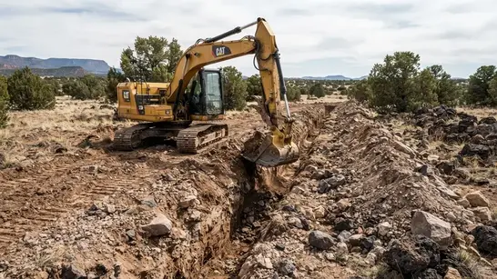
Rocky ground, caliche, volcanic material, changing elevations, and difficult access can increase excavation time and affect the equipment and methods required for rural utility trenching in Apache County.
Ready to Plan Utility Trenching on Your Apache County Property?
Get your rural utility trenching project evaluated based on the actual property and proposed utility route. Whether you need a water-line trench from a private well to a homesite, underground electrical conduit, communications conduit, or utility connections between a house, workshop, cabin, solar equipment, or other rural improvements, trenching requirements can vary significantly with route length, terrain, rock and caliche, access, crossings, existing improvements, and required excavation depth and width. Contact Apache County Land Services to discuss your project and receive an estimate based on the property's location, proposed trench alignment, utility type, ground conditions, equipment access, spoil handling, backfilling, and surface restoration requirements.
Call (928) 543-6447