
⭐ Land Grading • Leveling • Drainage Shaping • Building Pad Prep • Rural Site Preparation Across Apache County Arizona
Professional Land Grading & Leveling in Apache County, Arizona
Proper land grading is essential for creating a stable, usable property ready for homes, cabins, ranch improvements, and off-grid development. Apache County Land Services provides complete grading and leveling solutions including rough grading, finish grading, drainage shaping, slope correction, driveway grading, building pad preparation, and rural site development for properties throughout Apache County.
Serving St. Johns, Concho, Vernon, Sanders, Springerville, Eagar, Alpine, Greer, Nutrioso, Show Low and surrounding communities.
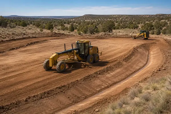
How Apache County Terrain Changes the Way Land Is Graded
Land grading in Apache County cannot be approached the same way on every parcel. Rural properties range from broad high-desert acreage around St. Johns, Concho, Vernon, Sanders, Chambers, and surrounding communities to higher-elevation and mountainous terrain near Springerville, Eagar, Alpine, Greer, and Nutrioso. Existing elevation changes, exposed rock, vegetation, soil conditions, natural drainage paths, and equipment access all affect how finished grades should be established.
The objective is not simply to make as much of the property flat as possible. Good rural grading establishes useful elevations, practical slopes, controlled drainage, and workable areas for the improvements the property owner actually plans to build.
-
High-Desert Acreage Near St. Johns, Concho & Vernon
Open rural parcels can appear relatively flat while still containing subtle elevation changes that determine where stormwater travels. Grading may focus on establishing usable building areas, correcting low spots, maintaining practical slopes, and preventing new improvements from becoming obstacles to natural drainage. -
Higher-Elevation & Mountain Terrain
Properties around Springerville, Eagar, Alpine, Greer, and Nutrioso can involve steeper slopes, exposed rock, irregular ground, forested areas, and more difficult equipment access. Grading must account for elevation changes and site access rather than simply trying to flatten the entire parcel. -
Ranch & Large-Acreage Properties
Larger rural properties may require grading in several separate areas instead of creating one finished surface. Access routes, barns, shops, livestock areas, equipment areas, future homesites, and drainage improvements can all influence how elevations should be developed across the property. -
Homesites, Cabins & Rural Building Areas
A future structure may require a relatively level building area while the surrounding ground needs to remain sloped for drainage. Grading establishes the relationship between the building area, surrounding terrain, driveway, and finished drainage rather than treating the pad as an isolated flat spot. -
Remote Access & Equipment Limitations
Rural parcels may have narrow entrances, rough existing roads, steep approaches, fences, trees, or long distances from established roads. These conditions can affect what equipment can reach the site and how grading work is staged. In some cases, existing routes may require access road and driveway improvements before larger grading equipment can work efficiently. -
Natural Drainage & Elevation Changes
Existing swales, low areas, washes, depressions, and gradual changes in elevation can determine where water naturally moves during storms. Grading should work with these conditions while creating controlled drainage around developed areas. -
Off-Grid Property Development
Remote properties often need grading coordinated with future access, solar equipment, water infrastructure, septic areas, utility corridors, and building locations. Establishing practical elevations early can reduce unnecessary rework as additional improvements are installed. -
Selective Disturbance on Rural Land
Large rural parcels do not necessarily need every portion disturbed. Grading can be concentrated around planned improvements while useful vegetation and natural terrain, and portions of the existing property can remain undisturbed where practical.
Two Apache County properties of the same acreage can require very different grading approaches. Terrain, elevation changes, soil and rock conditions, drainage, access, and the owner's development plans all influence the amount and type of earthwork required. Understanding those conditions before moving material helps create grades that remain useful after the project is complete.
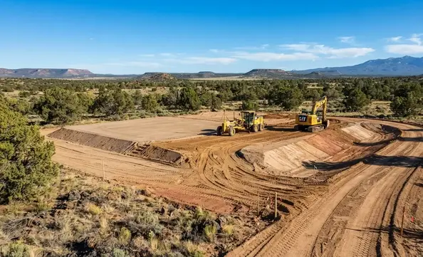
Professional grading works with Apache County's natural terrain by establishing usable elevations and slopes around building areas while preserving practical portions of the property's existing contours, vegetation, and drainage patterns.
Land Leveling Does Not Always Mean Making the Property Flat
One of the most important parts of rural grading is understanding that a usable property does not need to be perfectly flat. In Apache County, the best grading plans work with the land’s natural contours, high‑desert slopes, volcanic rock shelves, drainage washes, and mountain terrain, rather than removing every change in elevation. Proper leveling creates controlled grades that support construction, access, and long‑term drainage.
A building pad may need to be level and compacted, while the surrounding acreage remains sloped to carry water away from the structure. A driveway may require a consistent grade without being perfectly flat, especially on uneven or rocky terrain. Ranch roads, cabin access routes, and off‑grid driveways often benefit from gradual transitions rather than one continuous elevation. Effective grading shapes these relationships deliberately so the property functions correctly.
Level Where It Matters
Create stable, compacted building pads for homes, cabins, shops, barns, and equipment areas while leaving surrounding terrain intact. This reduces unnecessary disturbance and preserves natural land features that help with drainage and long‑term usability.
Preserve Useful Drainage
Shape grades so stormwater follows controlled paths instead of pooling near structures or flowing toward driveways. Proper drainage planning is essential in Apache County’s monsoon season, where unmanaged runoff can quickly create erosion or washouts.
Control Elevation Changes
Smooth abrupt transitions and establish practical slopes between building pads, driveways, access routes, drainage areas, and natural terrain. This improves usability, reduces erosion, and ensures equipment can safely access the property.
Limit Unnecessary Disturbance
On rural acreage, there is rarely a need to flatten the entire parcel. Strategic grading focuses on the areas that support construction, access, and infrastructure while preserving natural vegetation, terrain, and soil stability everywhere else.
Effective land leveling works with the existing terrain rather than removing it. By establishing practical elevations, controlled slopes, and stable building areas, grading supports construction, access, drainage, and long‑term property use while minimizing unnecessary disturbance to the land.
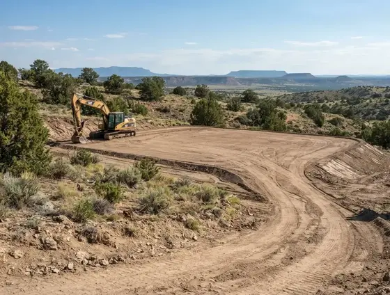
A properly graded building area can remain level and stable while the surrounding terrain retains controlled slopes that help manage drainage, connect with access routes, and preserve useful natural features.
Not Sure How Much of Your Apache County Property Should Be Graded?
Rural grading does not necessarily mean flattening an entire parcel. A homesite, driveway, cabin area, workshop, or other improvement may only require targeted grading while the surrounding terrain remains sloped for drainage and natural land use. Tell us what you are planning and which areas of the property need to function properly.
Call (928) 543-6447How We Evaluate an Apache County Property Before Grading
Proper grading starts with understanding how the property already functions before soil is moved. Apache County acreage can contain subtle elevation changes, natural drainage paths, exposed rock, uneven soils, existing roads, vegetation, and difficult equipment access that are not always obvious from looking across the property. Evaluating these conditions first helps determine where grading is actually needed and how finished elevations should work with the land's existing characteristics.
Existing Elevations & Slopes
High points, low areas, depressions, ridges, and changes in slope determine how much material may need to be moved and where finished grades can realistically be established. A parcel that looks generally level can still contain enough elevation difference to affect a homesite, driveway, drainage route, or other planned improvement.
Natural Drainage Patterns
Existing swales, low areas, washes, and concentrated runoff paths are important before new grades are established. Grading should account for where water already travels during storms and avoid creating conditions that redirect runoff toward buildings, driveways, neighboring areas, or erosion-prone portions of the property.
Soil, Rock & Subgrade Conditions
Apache County properties can contain rocky ground, volcanic materials, compacted soil, loose surface material, and varying subgrade conditions. These factors affect how easily material can be excavated and moved, whether suitable onsite fill is available, and what preparation may be required before a finished grade can be established.
Equipment Access & Staging
Remote acreage may have narrow entrances, rough roads, steep approaches, fences, trees, gates, or limited turning areas. Equipment access is evaluated before grading begins because the available route can influence equipment selection, work sequencing, material movement, and the overall efficiency of the earthwork.
Future Building Areas
Proposed homes, cabins, shops, barns, and other structures influence where finished elevations should be established. Grading the surrounding property correctly helps connect the future building area with driveways, drainage paths, utilities, and the existing terrain instead of creating an isolated flat area that does not work with the rest of the property.
Access & Future Infrastructure
Driveways, utility corridors, septic areas, wells, solar equipment, fencing, and other future improvements can all affect the grading layout. Considering these improvements before major earthwork helps reduce the possibility of grading one area and later having to disturb it again to install infrastructure.
This evaluation is why grading should not be treated as a simple price-per-acre service. Two properties with the same acreage can require very different amounts of earthwork depending on elevation changes, drainage, soil and rock conditions, access, existing improvements, and the owner's long-term plans. The more clearly those conditions are understood before work begins, the more effectively the finished grades can support the property's next stage of development.
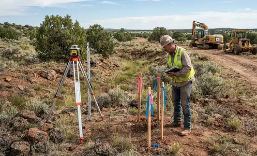
Evaluating existing elevations, drainage, soil, rock, vegetation, and equipment access before earthwork begins helps determine where grading is actually needed and how finished grades should work with the property.
Cut-and-Fill Grading for Uneven Apache County Properties
Many Apache County grading projects involve more than simply smoothing the surface. Rural parcels can contain a combination of high-desert slopes, volcanic rock, compacted soil, elevated areas, depressions, and low-lying drainage areas. When a property has both high and low sections, cut-and-fill earthwork can establish more useful elevations while reducing unnecessary hauling when suitable material can be reused onsite.
Cut-and-fill grading must account for the existing material, drainage, slope conditions, access, compaction requirements, and intended use of the finished area. Material that looks suitable at the surface may contain rock, organic debris, loose soil, or other conditions that make it inappropriate for certain applications. Some projects therefore require imported fill, aggregate, or additional subgrade preparation.
A typical cut-and-fill project may involve several different earthwork operations:
-
Cut High Areas
Elevated portions of the property can be excavated or reshaped to establish practical finished grades. Cutting high areas can create usable building locations, improve slope transitions, connect different elevations, and help establish more controlled drainage across the site. -
Build Low Areas
Lower portions of the property may be raised with suitable material to create usable surfaces, correct uneven elevations, improve access, or establish the desired relationship between a building area, driveway, and surrounding ground. -
Reuse Suitable Onsite Material
When conditions allow, material excavated from higher portions of the property can sometimes be redistributed into lower areas. Reusing suitable material can reduce hauling and make the earthwork more efficient, but the material must be appropriate for its intended placement and compaction requirements. -
Address Rock & Unsuitable Material
Apache County properties can contain volcanic rock, coarse material, loose soil, organic debris, or other conditions that affect whether excavated material can be reused as fill. Material that does not meet the needs of the project may need to be removed, processed, or replaced with more suitable material. -
Import Fill When Necessary
Some properties do not contain enough suitable onsite material to achieve the desired finished elevations. Imported fill, aggregate, or road-base material may be required to raise low areas, establish access routes, prepare construction areas, or achieve the required finished grade. -
Prepare & Compact Placed Material
Where fill is placed as part of the grading work, the preparation and compaction requirements depend on the material, depth of fill, soil conditions, and intended use. A smooth finished surface alone does not guarantee that the underlying subgrade has been properly prepared. -
Maintain Controlled Drainage
Cut-and-fill work must account for where water will travel after the elevations change. Finished grades should avoid trapping runoff against building areas, concentrating water unnecessarily, or creating new erosion paths across driveways and other developed portions of the property. -
Establish Finished Elevations
The final objective is not simply to move dirt from one location to another. Cut-and-fill operations establish practical elevations and transitions that work with the property's terrain and support future homesites, cabins, shops, driveways, drainage improvements, and other rural development.
The goal of cut-and-fill grading is to create stable, functional elevations while moving and importing only the material necessary for the project. When additional gravel, fill, or road-base material is needed, grading can be coordinated with material delivery, placement, compaction, and final shaping so the property is prepared for its next stage of development.
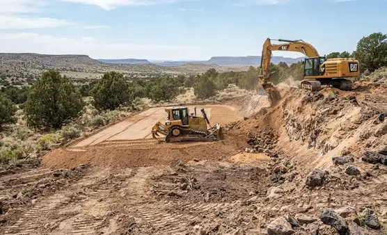
Cut-and-fill earthwork reshapes high and low portions of uneven acreage to establish practical elevations while allowing suitable onsite material to be redistributed when site conditions make reuse appropriate.
Rough Grading vs. Finish Grading for Apache County Properties
Rough grading and finish grading serve different purposes during rural site development. Rough grading establishes the major elevations, slopes, and overall shape of a property, while finish grading refines those surfaces for the next stage of construction or property use. Understanding the difference helps Apache County landowners determine what type of earthwork their property actually needs.
Major Rough Grading
Rough grading handles the larger earthwork required to establish the basic shape and elevations of a site. This can include cutting high areas, filling low areas, reshaping broad slopes, and establishing the general footprint of future building areas, driveways, and drainage routes. Raw acreage with significant elevation changes will often require this stage before more precise site preparation can begin.
Finish Grading
Finish grading refines the surface after major earthwork is complete. It addresses smaller elevation corrections, surface smoothness, transitions between graded areas, and final drainage direction. Finish grading may be appropriate for an existing homesite, previously disturbed parcel, driveway, or other area that already has its major elevations established.
Building Area Preparation
A future home, cabin, shop, or barn may require rough grading to establish the building area's general elevation followed by more precise finish grading. The surrounding ground also needs to work with the building area so surface water does not become trapped against the structure or directed toward the foundation area.
Driveway & Access Grading
Rural driveways may require both stages of grading. Rough grading establishes the route, elevation changes, and major slope transitions, while finish grading refines the driving surface before gravel, aggregate, or another final surface is placed. This is especially important on remote Apache County properties where drainage and washout resistance affect long-term access.
Drainage & Final Surface Shaping
Rough grading establishes the broad drainage layout, but finish grading can fine-tune surface slopes and transitions around developed areas. The finished surface should work with existing drainage patterns and provide controlled movement of stormwater without unnecessarily creating concentrated runoff across building areas, driveways, or other improvements.
Localized Grade Correction
Not every property needs complete site-wide grading. Some Apache County landowners may only have a low spot, uneven driveway approach, isolated drainage problem, or previously disturbed area that needs correction. Localized grading can address these specific conditions without unnecessarily disturbing the remainder of the property.
The right grading approach depends on the property's existing elevations, terrain, drainage, soil and rock conditions, access, and planned improvements. Some projects require substantial rough grading followed by finish work, while others only need targeted surface correction. Evaluating the property first helps determine which level of earthwork is actually necessary.
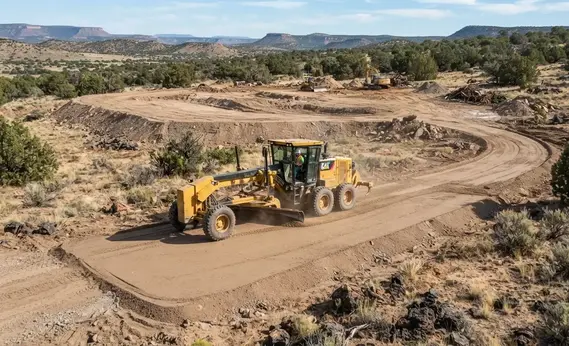
Rough grading establishes major elevations and slopes, while finish grading refines the surface, transitions, and drainage before a building area, driveway, or other improvement moves into its next stage.
Signs Your Apache County Property May Need Grading
Not every uneven rural parcel needs extensive earthwork. In many cases, the need for grading becomes apparent from how water, vehicles, slopes, and future construction areas interact with the existing ground. Recognizing these conditions early can help prevent drainage problems, difficult access, and unnecessary rework as the property is developed.
Water Collects in Low Areas
Persistent ponding, muddy sections, or saturated ground after rainfall can indicate that existing elevations are preventing water from leaving an area efficiently. These locations should be evaluated before placing a building, driveway, septic area, or other improvement.
Driveways Develop Ruts or Washouts
Repeated ruts and washouts can indicate that the existing driveway grade is concentrating runoff or lacks adequate surface shaping. Regrading can improve elevation transitions, drainage, and the foundation for gravel or other future surface improvements.
Water Moves Toward the Building Area
A proposed homesite should be evaluated when surrounding ground naturally directs runoff toward the future structure. Proper grading establishes a usable relationship between the building area, surrounding terrain, and drainage rather than simply creating a flat pad.
Large or Abrupt Grade Changes
Significant elevation changes can make building areas, driveway approaches, utility corridors, and other improvements difficult to develop. Grading can establish more practical transitions while working with the property's existing topography.
Existing Roads Redirect Runoff
Old two-tracks, ranch roads, and informal access routes can become unintended drainage channels. Reshaping these areas may be necessary before permanent driveways, gravel surfaces, culverts, or other improvements are installed.
The Proposed Building Area Is Uneven
A sloped or irregular homesite may require grading before a building pad or construction surface can be established. The surrounding elevations also need to be considered so the finished building area connects properly with access and drainage.
These conditions do not automatically mean the entire property needs to be leveled. Grading may only be necessary around a building area, driveway, drainage route, or other specific portion of the property. The appropriate approach depends on the property's terrain, existing elevations, drainage, soil and rock conditions, access, and planned improvements.
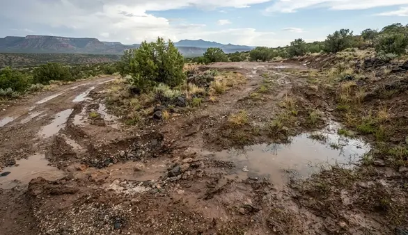
Ponding, muddy low areas, driveway ruts, washouts, and runoff moving toward future building areas can indicate that existing elevations and drainage patterns should be evaluated before further property development.
Dealing With Ponding, Washouts or Uneven Ground on Your Apache County Property?
Standing water, muddy low areas, driveway ruts, washouts, runoff moving toward a building area, or abrupt elevation changes can indicate that the existing grades need attention. If your property is experiencing one of these problems, tell us where the issue occurs and what you plan to use the area for.
Call (928) 543-6447Our Land Grading & Leveling Process
In Apache County, successful rural grading starts long before a blade touches the ground. High‑desert soils, seasonal monsoon runoff, and the natural contours of the Colorado Plateau require a grading approach that respects how the land already moves water and how future improvements will interact with the terrain. Our process is built around understanding your parcel’s unique conditions and shaping elevations that support long‑term use, access, and development.
1. Property & Project Review
Every Apache County parcel is different, from the sandy loam around Concho Lake to the clay-heavy soils near St. Johns and the rocky volcanic terrain closer to Springerville. We begin by reviewing your acreage, access points, terrain, vegetation, and intended use. Whether you're preparing a homesite, cabin pad, ranch improvement, driveway, utility corridor, septic system, well location, or solar installation, we evaluate how each element influences the grading strategy. Local factors like monsoon drainage, winter freeze-thaw cycles, and rural road conditions are considered from the start.
2. Existing Grade Assessment
Apache County land often includes natural swales, shallow washes, uneven mesas, and pockets of compacted caliche. We identify high points, low spots, drainage paths, depressions, exposed rock, and areas affected by seasonal runoff. This assessment helps determine where material truly needs to move, avoiding unnecessary earthwork and preserving natural drainage patterns that already work well. Understanding the land’s current elevations is essential before reshaping any portion of the parcel.
3. Site Layout & Development Planning
We map out proposed building areas, driveways, utility routes, septic locations, water lines and well locations, solar arrays, and future improvements. In Apache County, where parcels are often large and remote, coordinating these elements prevents conflicts later, such as a driveway directing water toward a homesite or a utility trench cutting through a future building pad. Proper layout planning ensures the grading supports long-term development instead of creating new problems.
4. Earthwork Planning
Based on the land’s natural elevations and your intended finished grades, we determine where material needs to be cut, filled, redistributed, imported, or removed. Apache County soils vary widely, some areas require ripping compacted caliche, while others need careful shaping of sandy or loose material. Equipment access, drainage direction, compaction needs, and the long-term use of each area all influence the earthwork plan.
5. Rough Grading
Rough grading establishes the major elevations, slopes, building pads, and access routes. Cut-and-fill operations are used to create practical elevations while minimizing disturbance to areas that don’t need reshaping. On Apache County parcels, this phase often includes shaping around natural washes, stabilizing loose soils, and creating workable transitions between flat building areas and sloped terrain.
6. Drainage & Slope Shaping
Proper drainage is critical in a region where monsoon storms can drop inches of rain in a single afternoon. We refine grades so runoff moves through the property in a controlled manner, reducing erosion, washouts, and ponding. Slopes and transitions are shaped around homesites, driveways, and other improvements to work with, not against, the land’s natural drainage patterns.
7. Finish Grading
After major earthwork is complete, finish grading refines the surface. This includes smoothing transitions, correcting minor elevation issues, shaping drainage direction, and preparing the area for construction, gravel placement, landscaping, or long-term use. Finish grading is especially important for homesites and driveways that must withstand Apache County’s seasonal weather patterns.
8. Prepare for the Next Development Phase
Completed grading sets the stage for the next steps: house-pad construction, driveway improvements, utility trenching, septic installation, well development, solar arrays, fencing, agricultural improvements, or other rural development. On large or remote Apache County parcels, proper grading early on prevents costly rework later, especially when correcting drainage or elevation issues requires additional excavation.
A properly graded Apache County property should do more than simply look level. It should establish practical elevations, usable slopes, controlled drainage, and smooth connections between the land’s natural terrain and your planned improvements. With the region’s unique soils, monsoon patterns, and rural access challenges, thoughtful grading is one of the most important steps in preparing a parcel for long-term use and development.
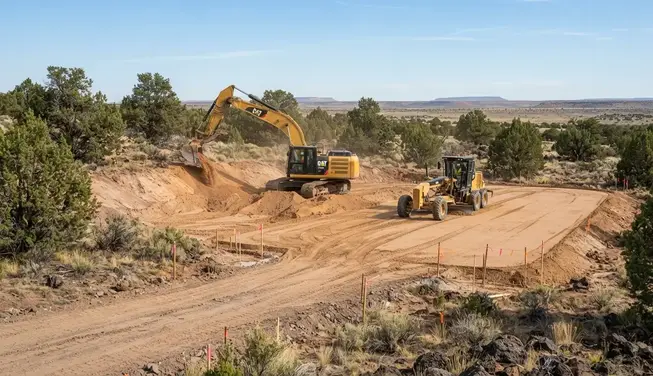
Professional grading combines site evaluation, earthwork, drainage shaping, elevation control, and finish grading to prepare rural Apache County properties for homesites, access, utilities, and future development.
Subgrade Preparation & Compaction Beneath the Finished Surface
A graded property can look smooth and level while still having an improperly prepared subgrade underneath. The surface appearance alone does not determine whether an area is suitable for its intended use. Where grading involves placed fill, significant elevation changes, or future construction, the condition of the underlying material matters just as much as the final shape.
Depending on the project, subgrade preparation may involve removing unsuitable surface material, placing appropriate fill, working material in manageable layers, conditioning the material as needed, and compacting the prepared area. The exact preparation required depends on the soil, moisture conditions, depth of fill, intended use, and project requirements.
A typical subgrade preparation project may involve several different earthwork operations:
-
Prepare the Existing Surface
Existing loose, disturbed, organic, or otherwise unsuitable material may need to be addressed before additional fill is placed. Preparing the underlying surface helps establish a more consistent foundation for subsequent earthwork and grading. -
Remove Unsuitable Material
Surface debris, organic material, loose soil, or other unsuitable material may need to be excavated before the area can be prepared for additional fill or future improvements. The extent of removal depends on existing site conditions and the intended use of the finished area. -
Place Suitable Fill Material
Fill requirements depend on the project and the material available onsite or brought to the property. Suitable fill and aggregate material can be placed where additional elevation, structural support, or improved surface conditions are needed. -
Place Material in Manageable Layers
Where significant fill is required, material may need to be placed and worked in controlled layers rather than simply dumped into the area. Layer placement allows the underlying material to be prepared progressively as the finished elevation is established. -
Condition Material as Needed
Soil moisture can affect how material behaves during grading and compaction. Depending on the material and site conditions, moisture may need to be managed so the fill can be shaped and compacted appropriately. -
Compact the Prepared Subgrade
Compaction helps reduce excessive voids and establish a more stable subgrade where the project requires placed fill or prepared earthwork. The appropriate compaction approach depends on the material, depth, moisture conditions, and intended use. -
Establish Finished Elevations
Once the underlying material has been prepared, the surface can be shaped to the intended elevations and transitions. Final grading should connect properly with surrounding terrain, access routes, drainage, and other planned improvements. -
Prepare for the Intended Use
The required level of subgrade preparation depends on what the area will ultimately support. Building areas, driveways, septic improvements, utility corridors, gravel surfaces, and other applications can have different preparation requirements.
For engineered building foundations, structural slabs, roads, septic systems, or other regulated improvements, project-specific engineering, testing, design, and inspection requirements may apply. Grading and subgrade preparation should be coordinated with those requirements rather than assuming that a visually level surface is sufficient for every application.
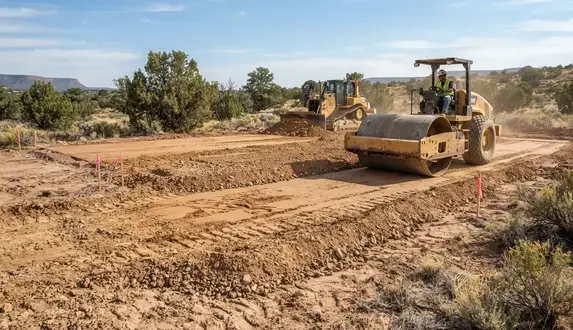
Proper subgrade preparation can involve preparing existing soil, placing suitable fill in manageable layers, conditioning material as needed, and compacting the prepared surface for its intended use.
Need Proper Subgrade Preparation for Your Apache County Project?
A smooth finished surface does not necessarily mean the underlying ground has been properly prepared. If your project involves placed fill, significant elevation changes, a building area, driveway, or other improvement where subgrade conditions matter, tell us about the property and what the finished area needs to support.
Call (928) 543-6447Grading for Drainage & Water Control on Apache County Properties
Grading is not only about creating usable elevations. The finished shape of the property also determines where rainfall and runoff will travel. Apache County properties can experience intense monsoon rainfall, natural washes, sloped terrain, and localized low areas, making drainage an important consideration when establishing building sites, driveways, and other developed areas.
Effective grading works with the property's existing topography rather than simply moving water somewhere else. The objective is to establish practical slopes and elevation changes that allow runoff to move away from areas that need to remain usable while avoiding unnecessary erosion, ponding, or concentrated flow.
Drainage considerations during grading may include:
-
Direct Water Away From Building Areas
Finished grades around a homesite should account for surrounding elevations and runoff paths so rainfall does not naturally collect against the future building area or flow toward the structure. -
Shape Driveways for Runoff
Driveway grades influence how quickly water crosses the surface and where runoff leaves the access route. Proper shaping can reduce rutting, washouts, and erosion while providing a more durable foundation for gravel or other surfacing. -
Work With Existing Drainage Paths
Natural drainage patterns, shallow swales, washes, and low areas should be considered before changing elevations. Grading that ignores existing flow paths can redirect water into areas that were not previously exposed to concentrated runoff. -
Account for Monsoon Runoff
Heavy summer storms can produce rapid runoff across rural properties. Grading should consider how water will move during larger rainfall events rather than relying only on conditions observed during dry weather. -
Reduce Erosion & Concentrated Flow
Concentrating runoff through an improperly shaped slope, driveway, or disturbed area can increase erosion. Finished grades should avoid creating unnecessary channels or abrupt transitions that accelerate water across vulnerable surfaces. -
Coordinate Drainage With Future Improvements
Building pads, septic areas, driveways, utility corridors, barns, shops, and other planned improvements can change how water moves across the property. Considering these improvements together helps prevent grading conflicts later. -
Preserve Useful Natural Slopes
Not every slope needs to be eliminated. In many cases, retaining practical portions of the existing terrain can provide more natural drainage while reducing unnecessary excavation, fill placement, and disturbance. -
Establish Practical Finished Grades
The final grading objective is to create elevations that support the property's intended use while allowing water to move in a controlled manner. Finished grades should work with the terrain, access, soil conditions, and planned development rather than simply making the land appear flat.
Drainage conditions can vary significantly from one Apache County property to another. Where drainage improvements involve engineered systems, regulated structures, significant waterways, or other specialized conditions, project-specific design and permitting requirements may apply. Grading should be coordinated with those requirements when necessary.
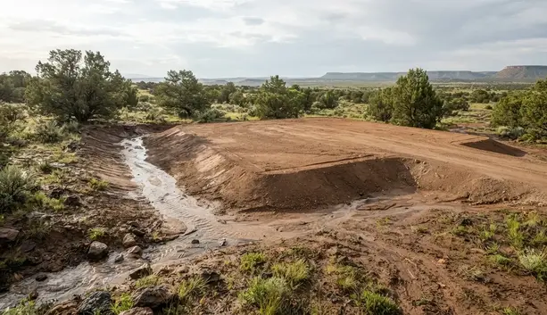
Proper grading creates controlled slopes that allow stormwater to move away from building areas and across the property without creating unnecessary ponding, erosion, or concentrated runoff.
Land Grading for Different Apache County Property Uses
Grading requirements depend heavily on what you plan to do with the property. A homesite, private driveway, cabin, workshop, ranch improvement, or recreational area may each require different elevations, slopes, drainage considerations, and surface preparation. Rather than leveling an entire parcel unnecessarily, grading can focus on the areas that need to function properly for the property's intended use.
Homesites & Building Areas
Building areas often require practical finished elevations that connect properly with surrounding terrain, access, and drainage. Grading may establish a usable house pad while preserving appropriate slopes around the site rather than flattening the entire property.
Private Driveways & Access Roads
Rural driveways must work with existing slopes while providing reliable vehicle access. Grading can improve elevation transitions, address uneven sections, establish drainage paths, and prepare the route for gravel or other surface improvements.
Shops, Barns & Outbuildings
Workshops, barns, garages, storage buildings, and other outbuildings may require dedicated graded areas that connect with existing access and surrounding ground. Localized grading can create practical building areas without disturbing more of the property than necessary.
Off-Grid Development Areas
Off-grid properties may require coordinated areas for cabins, solar equipment, water systems, septic improvements, storage, gardens, and access. Grading can help establish usable relationships between these improvements while accounting for the property's natural terrain and drainage.
Ranch & Agricultural Improvements
Ranch properties may need grading for equipment access, livestock areas, agricultural structures, storage areas, or other improvements. The objective is often to create usable working surfaces while maintaining practical drainage across the surrounding acreage.
Recreational & Open Areas
Property owners may want improved areas for camping, outdoor recreation, parking, gathering spaces, or other personal uses. Localized grading can improve usability and drainage while retaining natural features and avoiding unnecessary disturbance to the rest of the parcel.
The right grading approach depends on the specific area being improved and what it needs to support. On large rural parcels, grading does not necessarily mean reshaping the entire property. Targeted improvements can create functional building areas, access routes, drainage transitions, and working surfaces while preserving useful portions of the existing terrain.
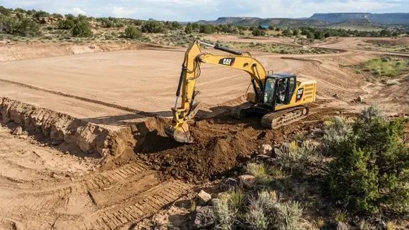
Professional land grading can create stable, functional areas for homesites, driveways, cabins, workshops, ranch improvements, and recreational uses while preserving natural terrain and avoiding unnecessary leveling across the entire property.
Localized Grading Can Be Better Than Leveling the Entire Property
Rural Apache County parcels almost never need the entire acreage cut to one elevation. With the region’s mix of high-desert flats, shallow washes, caliche shelves, and rolling mesa terrain, the most practical and cost‑effective approach is often to grade only the areas needed for a homesite, driveway, drainage improvement, outbuilding, or working space. Targeted earthwork reduces unnecessary excavation, preserves natural land features, and respects how the property already handles water during monsoon season.
Leaving portions of the natural landscape intact can also protect existing drainage paths, mature juniper and pinyon growth, usable slopes, and the character of the land. Many Apache County parcels have terrain that already works well, especially in areas where washes carry seasonal runoff or where natural high points offer ideal building pads. The goal is to create functional improvements without disturbing more ground than the project requires.
Localized grading may be the best approach when a property has:
A Specific Building Area
Homesites, cabins, shops, garages, and RV pads often only require a prepared building surface. Many Apache County parcels include natural benches or elevated flats that make ideal building locations without reshaping the entire acreage.
A Defined Access Route
Driveways and private roads frequently need their own grading, crowning, and drainage improvements, especially in areas with sandy soils or monsoon washouts. Surrounding land usually does not need leveling to support a functional access route.
A Localized Drainage Problem
Low spots, erosion channels, or runoff paths may require targeted reshaping rather than extensive earthwork. In Apache County, localized excavation and site preparation may be used where existing grades need to be adjusted before water can move toward an appropriate drainage path.
A Planned Outbuilding or Working Area
Barns, shops, equipment pads, livestock areas, and storage zones often need a dedicated graded surface. The surrounding terrain, especially if it includes usable slopes or natural windbreaks, can usually remain untouched.
Natural Terrain Worth Preserving
Many Apache County parcels include mature junipers, natural rock outcroppings, gentle slopes, or scenic high points that add value to the land. Localized grading allows these features to remain intact while still preparing the areas needed for development.
Limited Earthwork Is More Practical
On large or remote parcels, moving less material can significantly reduce hauling, equipment time, and disturbance. Targeted grading creates the elevations needed for construction while keeping costs and site impact manageable, especially in rocky or caliche-heavy areas.
Whole-property leveling is sometimes appropriate, but it is rarely the best solution for Apache County’s varied terrain. The right grading strategy depends on the land’s natural topography, soil and rock conditions, drainage patterns, access points, intended improvements, and the amount of usable ground that actually needs to be reshaped. Localized grading often delivers better results with less disturbance, while preserving the natural features that make rural Arizona properties unique.
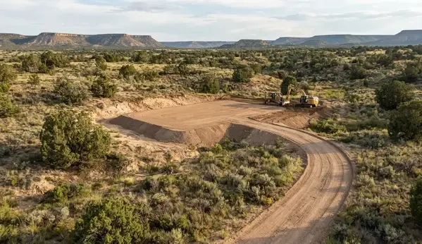
Localized grading can prepare specific homesites, access routes, drainage areas, and working spaces while preserving natural slopes, vegetation, washes, and other usable features across the rest of a rural Apache County property.
Need a Specific Area of Your Apache County Property Graded?
Not every rural property needs to be completely leveled. Localized grading can prepare a homesite, driveway, access route, drainage area, RV area, workshop site, or other working space while leaving suitable natural terrain and vegetation undisturbed. Tell us which areas of your property need to be prepared and what you plan to use them for.
Call (928) 543-6447What Land Grading Can and Cannot Correct
Land grading can correct many surface and elevation problems, but it is not a substitute for every type of site development or engineering. Understanding what grading can accomplish helps property owners choose the right type of preparation and avoid expecting a simple earthwork project to solve conditions that require additional work.
Depending on the property and intended use, grading can improve surface elevations, access, drainage patterns, slopes, and localized building or working areas. Other conditions may require excavation, imported material, engineered design, utility work, drainage structures, or additional site preparation.
Land grading can often address:
Uneven Elevations
Grading can reshape high and low areas to establish more practical finished elevations for building areas, driveways, working surfaces, and other planned improvements.
Surface Drainage Issues
Appropriate grading can improve the direction and movement of surface runoff by correcting problematic slopes, low areas, and transitions that contribute to ponding or uncontrolled surface flow.
Poor Access Grades
Existing driveways, two-tracks, and access routes can sometimes be reshaped to create more practical slopes, smoother transitions, and better drainage for future surface improvements.
Localized Slope Problems
Certain steep or abrupt transitions can be reshaped when site conditions allow, creating more usable relationships between building areas, driveways, and surrounding terrain.
Preparation for Future Improvements
Grading can establish preliminary elevations for homesites, cabins, shops, barns, driveways, utility corridors, septic areas, and other improvements that require prepared ground.
Existing Surface Conditions
Disturbed, rutted, uneven, or poorly shaped areas can often be reworked to create a more functional surface, provided the underlying soil, rock, drainage, and fill conditions are suitable for the intended use.
Grading alone may not correct conditions such as unstable soils, significant bedrock, major drainage structures, inadequate fill, utility conflicts, septic limitations, or structural foundation requirements. These situations may require additional excavation, imported material, engineering, testing, permitting, or specialized construction work.
The goal of grading is to establish practical ground conditions for the next stage of property development, not to assume that every site problem can be solved by moving soil. Evaluating the existing terrain, material, drainage, access, and intended use helps determine whether grading alone is appropriate or should be combined with other site preparation services.
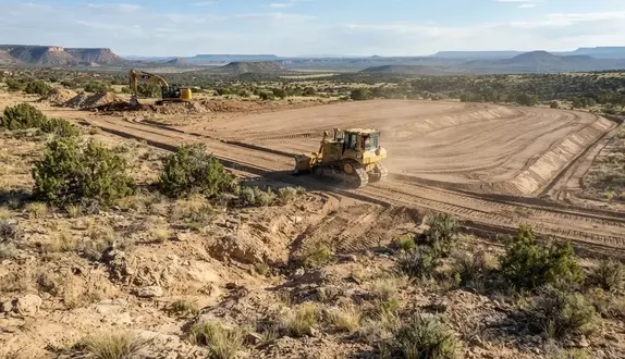
Grading can correct uneven elevations, surface drainage, poor slopes, and localized ground conditions while preparing practical surfaces for homesites, driveways, and future rural improvements.
Land Grading vs. Excavation: What's the Difference?
Land grading and excavation are related earthwork services, but they solve different problems. Excavation removes or relocates material to create depth, space, or access, while grading shapes the surface to establish usable elevations, slopes, and drainage. Many Apache County projects use both services as part of the same site-preparation process.
The distinction is mainly based on what the earthwork is intended to accomplish. Excavation generally creates space or changes the ground at a deeper level, while grading establishes the finished shape and elevation of the surface. Depending on the property, one project may require only grading, while another may require excavation followed by grading.
Common ways grading and excavation work together include:
-
Land Grading
Grading reshapes the ground surface to establish practical elevations, slopes, drainage patterns, building areas, driveway transitions, and other usable finished surfaces. -
Excavation
Excavation removes or relocates material to create depth, trenches, lower elevations, drainage channels, septic areas, utility corridors, or other below-grade spaces. -
Cut-and-Fill Earthwork
Higher areas may be excavated or cut down while suitable material is redistributed into lower areas. Grading then shapes the resulting surface to the desired elevations and slopes. -
Building Areas & Homesites
Excavation may remove unsuitable material or create the required depth, while grading establishes the building pad and transitions it into surrounding terrain and drainage. -
Driveways & Access Routes
Excavation may be necessary where terrain is too high, uneven, or obstructed, while grading establishes workable slopes, drainage, and a finished surface for gravel or road base. -
Drainage Improvements
Excavation can create or deepen swales, channels, and other drainage features, while grading shapes the surrounding ground so runoff moves toward the intended drainage path. -
Rock & Hard Ground
Caliche, volcanic rock, shallow bedrock, or other hard material may require excavation or ripping before the area can be shaped to the desired elevation and slope. -
Site Preparation & Development
Rural development projects may combine excavation and grading for building areas, utilities, septic systems, access routes, drainage improvements, equipment areas, and other improvements.
Understanding the difference helps determine which type of earthwork is appropriate for a particular Apache County property. Some projects only need localized surface correction, while others require excavation before finished grades can be established. Terrain, soil and rock conditions, drainage, access, and planned improvements all influence the appropriate approach.
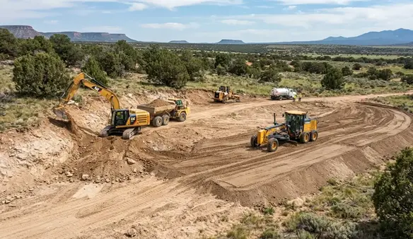
Excavation changes the depth or location of earth, while grading establishes finished elevations, slopes, and drainage. Many Apache County site-preparation projects use both processes to create usable development areas.
What We Evaluate Before Grading an Apache County Property
Every Apache County property has different grading requirements. A parcel that appears mostly level may still have drainage problems, unsuitable material, abrupt elevation changes, or access limitations that affect the work. Evaluating the existing conditions first helps determine where grading is actually needed and how the finished elevations should relate to the rest of the property.
The scope of grading depends on more than how uneven the ground looks. Terrain, soil and rock conditions, drainage, access, intended use, and future improvements all influence how much earthwork is appropriate and where material should be moved.
Important grading considerations may include:
-
Existing Terrain & Elevations
High points, low areas, slopes, depressions, ridges, and abrupt elevation changes help determine which portions of the property may need to be cut, filled, reshaped, or preserved. -
Soil & Surface Material
Soil composition, loose material, compacted areas, volcanic rock, shallow bedrock, and organic material can all affect excavation, fill placement, grading methods, and subgrade preparation. -
Drainage & Runoff Patterns
Existing washes, low areas, swales, runoff paths, and natural drainage patterns are considered so grading does not unintentionally redirect water toward buildings, driveways, or other developed areas. -
Property Access
Existing roads, gates, two-tracks, slopes, and available equipment access can influence how machinery reaches the grading area and how efficiently material can be moved around the property. -
Intended Property Use
A homesite, cabin, shop, barn, driveway, recreational area, or agricultural improvement may require different finished grades and levels of surface preparation. -
Future Development Plans
Planned utilities, septic systems, wells, solar equipment, additional structures, and access improvements can affect where grading should occur and how finished elevations should be established. -
Cut-and-Fill Requirements
Existing high and low areas are evaluated to determine whether suitable onsite material can be redistributed or whether additional fill, aggregate, or removal may be necessary. -
Finished Grade Objectives
The final elevations should support the property's intended use while creating practical transitions between buildings, driveways, drainage areas, and the surrounding natural terrain.
A thorough assessment helps prevent unnecessary earthwork and makes it easier to identify issues that should be addressed before grading begins. For projects involving engineered foundations, regulated drainage systems, septic installations, or other specialized improvements, additional professional design, testing, surveying, or permitting may be required.
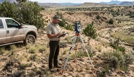
Evaluating existing elevations, soil and rock conditions, drainage, access, and planned improvements helps determine where grading is needed and how finished surfaces should transition into the surrounding Apache County terrain.
Need Your Apache County Property Evaluated Before Grading?
Existing elevations, soil and rock conditions, drainage patterns, equipment access, vegetation, and your future development plans can all affect where grading is needed and how finished surfaces should transition across the property. If you are unsure where to place or how to prepare a homesite, driveway, pad, or other development area, tell us about your property and what you are planning.
Call (928) 543-6447Land Grading and Leveling Costs Throughout Apache County
Grading costs in Apache County vary because the land changes from one area to another. Some parcels sit on sandy soil near Concho that shapes easily. Others in St. Johns, Vernon, or Sanders have hard caliche or scattered volcanic rock that takes more time and equipment to break up. Access also affects pricing since many rural parcels are reached by long easements, two tracks, or seasonal roads that slow production.
For these reasons, grading is priced by the actual earthwork required rather than a simple per acre formula. A large parcel may only need a small homesite pad and driveway. A smaller parcel with steep slopes or heavy rock may require more work. Evaluating the land first helps determine the most practical approach and avoids unnecessary disturbance.
Typical Apache County Grading Investment Ranges
Small Homesite and Building Area Grading
$2,500 to $8,000+
Suitable for cabin pads, RV sites, small homesites, and workshop areas. Pricing reflects local soil conditions, slope correction, access, and the amount of finish work needed to create a stable building surface. Sandy soil grades quickly while caliche or rock takes more time.
Driveway and Access Route Grading
$3,000 to $12,000+
Used for rural driveways ranging from short entry routes to long two-track upgrades. Work may include shaping, crowning, drainage improvements, and preparing the surface for gravel or road base. Costs increase with route length, terrain, washouts, and areas where rock or caliche must be cut through.
Cut and Fill and Elevation Correction
$5,000 to $20,000+
Used when a property has noticeable high and low areas that need reshaping. Pricing is driven by the volume of material moved and whether suitable fill exists onsite. Parcels with caliche shelves, uneven mesa edges, or rocky terrain often fall toward the higher end of the range.
Drainage and Grade Correction
$3,000 to $15,000+
Addresses ponding, erosion channels, seasonal runoff paths, and areas affected by monsoon flow. Work may include targeted excavation, reshaping slopes, adding imported material, or installing culverts. Costs depend on the severity of the drainage issue and how water moves across the property.
Large Rural Property Grading
$10,000 to $50,000+
Common for parcels that need multiple improvements such as homesites, driveways, shop pads, equipment areas, and drainage work. Pricing reflects the number of areas being graded, the distance between them, terrain complexity, and the total volume of earthwork. Remote parcels often require additional equipment time.
Rocky, Steep, and Difficult Terrain
Custom Quote
Necessary for properties with exposed volcanic rock, steep slopes, heavy caliche, or limited equipment access. These sites often require ripping, additional excavation, or staged equipment movement. Costs vary based on the terrain and the amount of rock or hardpan that must be broken up.
Every Apache County grading project begins with a site evaluation to understand the land’s natural elevations, soil and rock conditions, drainage patterns, access, and intended use. This helps create a grading plan that fits the property and provides a clear project estimate.
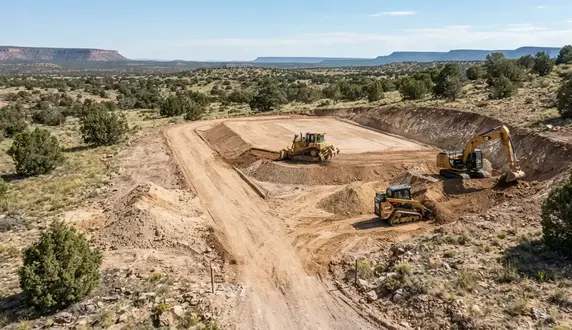
Apache County grading costs depend on the actual earthwork required, including terrain, soil and rock conditions, access, drainage, material movement, and the size and complexity of the areas being prepared.
Factors That Affect Land Grading Costs in Apache County
Land grading costs can vary substantially from one Apache County property to another. Acreage alone does not determine the amount of work required. Existing elevations, soil and rock conditions, drainage, equipment access, material movement, and the intended use of the finished area can all affect the total scope of a grading project.
A smaller property with difficult terrain may require more earthwork than a larger parcel with naturally usable elevations. Likewise, a homesite that only needs minor surface correction can cost considerably less than a building area requiring extensive cut-and-fill work, imported material, drainage corrections, and subgrade preparation.
Existing Elevation Changes
The difference between existing high and low areas affects how much material must be cut, moved, filled, or redistributed. Properties with significant elevation changes generally require more earthwork than areas that already have practical grades.
Soil & Rock Conditions
Rocky ground, volcanic material, compacted soils, caliche, loose surface material, and unsuitable fill can all affect production and equipment requirements. Difficult material may require additional excavation, processing, removal, or imported fill.
Drainage Requirements
Projects that require drainage corrections, slope reshaping, runoff control, or protection of existing drainage paths may involve more earthwork than simple surface leveling. The finished grades must also account for how stormwater will move after construction.
Equipment Access
Remote properties may have narrow entrances, rough roads, steep approaches, gates, fences, trees, or limited staging areas. Difficult access can affect equipment selection, setup, travel time, material movement, and overall project efficiency. Existing routes may sometimes require driveway or access-road improvements before larger grading equipment can work efficiently.
Imported Fill & Material
Some properties have enough suitable material onsite for portions of the grading work, while others require imported fill, aggregate, or road-base material. Material availability and hauling requirements can significantly affect the overall project cost.
Subgrade Preparation
Projects involving placed fill or future construction may require additional preparation beneath the finished surface. Removing unsuitable material, placing fill in manageable layers, conditioning material, and compacting the subgrade can increase the scope of work.
Size & Length of the Work Area
The size of the area being graded matters, but so does the shape and layout of the project. A long driveway, multiple building areas, or several separated work zones can require more equipment movement and grading time than one compact area of similar acreage.
Intended Property Use
A recreational area, driveway, building pad, barn site, septic area, or other improvement may require different finished elevations and levels of preparation. The intended use helps determine how precisely the area needs to be graded and what preparation is appropriate.
Project Complexity & Work Sequencing
Projects involving multiple graded areas or several phases of development may require more detailed sequencing than a single localized grading area. Coordinating cut-and-fill work, drainage, access, material placement, and future improvements can affect equipment time and the overall complexity of the project.
The most accurate grading estimate comes from evaluating the actual property rather than relying on acreage alone. By considering terrain, material, drainage, access, material availability, intended use, and project complexity, the scope can be defined more accurately and unnecessary earthwork can be avoided.
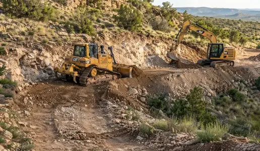
Terrain, rock and soil conditions, drainage, equipment access, imported material, earthwork volume, and the intended use of the finished area can all influence the scope and cost of an Apache County grading project.
Need a Property-Specific Land Grading Estimate?
Grading costs depend on the actual conditions of your Apache County property. Terrain, elevation changes, rock and soil conditions, drainage, equipment access, imported material, earthwork volume, and the intended use of the finished area can all affect the project scope. Tell us where your property is located, what area needs grading, and what you plan to use the finished area for.
Call (928) 543-6447Land Grading Project Considerations in Apache County
Apache County grading projects are shaped by local terrain, weather, soil conditions, access, and the type of improvements planned. The region’s mix of sandy soil, caliche, volcanic rock, seasonal monsoon storms, winter freeze cycles, and remote access routes can influence how earthwork is scheduled and completed. Considering these factors early helps create a practical grading plan for rural properties across St. Johns, Concho, Vernon, Sanders, and Alpine.
Weather and Seasonal Conditions
Summer monsoon storms can create fast runoff and soft ground. Winter freeze and thaw cycles can affect compaction and equipment movement. Planning around seasonal conditions helps avoid delays and protects freshly graded areas.
Soil Moisture and Material Behavior
Apache County soils behave differently when wet or dry. Sandy soil shapes easily while clay and caliche can become difficult when saturated. Moisture levels influence how material can be cut, placed, and compacted during grading.
Equipment Access and Travel Routes
Many rural parcels are reached by long easements, two tracks, or seasonal roads. Narrow entrances, soft ground, and uneven approaches can affect equipment selection and staging. Access planning helps keep production efficient.
Rock and Hard Ground Conditions
Volcanic rock, caliche shelves, and compacted ground are common in parts of Apache County. These conditions may require ripping, heavier equipment, or additional excavation to reach workable elevations.
Fill Material and Onsite Resources
Some parcels have suitable onsite material for fill and shaping. Others require imported aggregate or road base. Material availability affects hauling needs and the overall grading approach.
Drainage During Earthwork
Open cuts, loose fill, and unfinished slopes can be vulnerable to runoff. Temporary drainage planning helps protect the site during grading and supports the final drainage layout once work is complete.
Vegetation and Natural Features
Junipers, brush, washes, rock outcroppings, and existing roads can influence where equipment can operate. Coordinating grading with selective land clearing helps limit disturbance to areas that do not need reshaping.
Project Size and Earthwork Volume
Small pad corrections require limited material movement. Larger projects with multiple graded areas or significant elevation changes involve more equipment time and planning. Earthwork volume is one of the main cost drivers.
Coordination With Other Improvements
Grading often supports future work such as driveways, utilities, septic systems, wells, solar arrays, fencing, and building pads. Planning the sequence helps avoid disturbing newly finished areas later.
Parcel Location and Travel Distance
Remote parcels in areas like Witch Wells, Red Sky Ranch, or north of Sanders may require longer equipment travel times. Distance affects scheduling, fuel use, and the overall logistics of the grading project.
These factors do not prevent grading, but they influence how the work is planned and carried out. Evaluating weather, soil, terrain, access, material availability, drainage, and future improvements helps create a grading plan that fits the specific conditions found across Apache County.
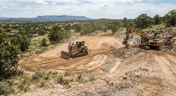
Apache County grading projects must account for local terrain, seasonal weather, soil moisture, rock and caliche, drainage, equipment access, vegetation, and the property's future development needs.
Service Area
We provide professional land grading and leveling services throughout Apache County, Arizona. Our work supports homeowners, ranchers, agricultural users, cabin owners, and rural landowners with rough grading, finish grading, drainage shaping, slope correction, driveway grading, building pad preparation, and complete rural site development for future construction.
- St. Johns, AZ
- Springerville, AZ
- Eagar, AZ
- Concho, AZ
- Vernon, AZ
- Sanders, AZ
- Alpine, AZ
- Nutrioso, AZ
- Greer, AZ
- McNary, AZ
- Ganado, AZ
- Window Rock, AZ
- Adamana, AZ
- Chambers, AZ
- Houck, AZ
- Lupton, AZ
- Many Farms, AZ
- Rock Point, AZ
- Round Rock, AZ
- Wide Ruins, AZ
- Surrounding Rural Communities
If you're located anywhere in Apache County or the surrounding rural communities, we can help grade and level your land for homesites, cabins, ranch projects, agriculture, recreation, and off‑grid development. Our grading services are designed around Arizona’s unique terrain, soil conditions, drainage patterns, and rural property requirements.
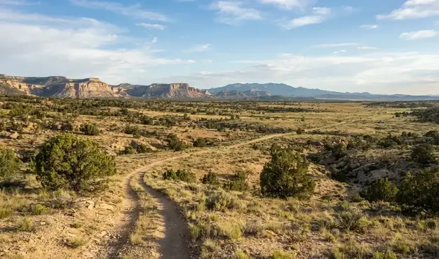
Land grading and leveling services support rural properties throughout Apache County, from homesites and ranches to cabins, agricultural areas, access routes, and off-grid development projects.
Land Grading & Leveling FAQs
Land grading and leveling in Apache County involves more than making uneven ground look smooth. Rural properties can have changing elevations, rocky or compacted soils, natural drainage paths, washes, slopes, existing roads, and difficult equipment access. The answers below address common questions about grading, leveling, drainage, cut-and-fill earthwork, building areas, driveways, rural development, and site preparation throughout Apache County.
- What is the difference between land grading and land leveling?
- Land leveling generally refers to reducing uneven elevations across a defined area, while grading is the broader process of establishing specific elevations, slopes, transitions, and drainage patterns. A properly graded property does not necessarily need to be completely flat. In many Apache County projects, selected areas are leveled while surrounding terrain remains sloped to preserve useful drainage and reduce unnecessary earthwork.
- Does an entire Apache County property need to be leveled?
- No. Large rural parcels often benefit from localized grading rather than whole-property leveling. A project may focus on a homesite, driveway, cabin area, shop, barn, equipment pad, drainage problem, or other specific improvement while leaving functional portions of the natural terrain undisturbed.
- What types of land grading projects do you handle?
- Grading work can include rough grading, finish grading, localized grade correction, cut-and-fill earthwork, building area preparation, driveway and access grading, drainage shaping, slope transitions, working areas, and preparation for future rural development. The appropriate scope depends on the property's existing conditions and intended use.
- What conditions are evaluated before grading begins?
- Important considerations include existing elevations, slopes, low areas, drainage paths, soil and surface material, exposed rock, existing roads, equipment access, vegetation, proposed building areas, and future improvements. Understanding these conditions helps determine where material should be cut, filled, redistributed, imported, or left undisturbed.
- Can grading be performed on sloped or mountainous property?
- Grading can be performed on many sloped rural properties, but the appropriate approach depends on the severity of the slope, ground conditions, access, drainage, and intended use. Rather than automatically flattening steep terrain, grading can establish practical transitions and usable areas while retaining portions of the existing slope where appropriate.
- What is cut-and-fill grading?
- Cut-and-fill grading reshapes a property by cutting down higher areas and using suitable material to raise lower areas when conditions allow. Reusing appropriate onsite material can reduce hauling, but not every excavated material is suitable for fill. Rock, organic material, loose soil, or other unsuitable material may require separate handling or replacement.
- Can you reuse soil from one part of the property to fill another?
- Sometimes. Reusing onsite material can make cut-and-fill projects more efficient when the material is suitable for its intended placement. Soil composition, rock content, moisture, organic material, placement depth, and intended use all affect whether excavated material can be reused as fill.
- Will I need imported fill or additional material?
- Not every project requires imported material. Additional fill, aggregate, or road-base material may be needed when the property does not contain enough suitable material to reach the desired elevations or when the existing material is unsuitable for the intended application. The need depends on the site's conditions and project requirements.
- Does grading include compaction?
- Compaction may be part of grading and subgrade preparation when the project involves placed fill or prepared surfaces that require additional stability. The appropriate preparation depends on the material, moisture conditions, depth of fill, and intended use. Engineered building areas or other regulated improvements may also require project-specific testing, inspection, or compaction requirements.
- Can grading improve drainage on rural property?
- Appropriate grading can improve surface drainage by establishing practical slopes, correcting low areas, and creating controlled transitions between developed areas and surrounding terrain. The goal is not simply to move water elsewhere, but to understand existing runoff patterns and avoid creating new erosion, ponding, or concentrated-flow problems.
- Can grading help prevent driveway washouts?
- Proper driveway grading can improve slope transitions, surface drainage, and the overall shape of an access route, which may reduce conditions that contribute to rutting and washouts. However, long-term driveway performance can also depend on drainage structures, surface material, traffic, soil conditions, and the intensity of storm runoff.
- Can you grade a property for a home, cabin, or building pad?
- Yes. Grading can establish a practical building area and connect its finished elevation with surrounding terrain, access, and drainage. The required level of preparation depends on the proposed structure and applicable project requirements. Structural foundation design, engineering, testing, and inspection are separate considerations when required.
- Can grading be coordinated with driveways, septic, wells, and utilities?
- Yes. Planned driveways, utility corridors, septic areas, wells, solar equipment, buildings, and other improvements can influence where finished grades should be established. Coordinating these elements before major earthwork can reduce conflicts and unnecessary regrading later. Septic, well, utility, and other regulated installations may have separate design and permitting requirements.
- What is the difference between rough grading and finish grading?
- Rough grading establishes the major elevations, slopes, building areas, access routes, and broad drainage layout. Finish grading refines those surfaces by correcting smaller elevation differences, smoothing transitions, and establishing the final surface shape needed for the next stage of construction or property use. Some projects require both stages, while smaller projects may only need localized grading or finish work.
- Can you correct an existing uneven driveway or low area?
- Yes. Localized grading can address isolated low spots, uneven driveway approaches, rutted areas, poor slope transitions, drainage problems, or previously disturbed ground when the underlying site conditions are suitable. This can often be more practical than reshaping the entire property.
- What types of soil and rock can affect grading in Apache County?
- Rural Apache County properties can contain varying soil conditions, compacted areas, loose surface material, caliche, coarse rock, volcanic material, and shallow or exposed rock. These conditions affect excavation, material handling, cut-and-fill work, grading methods, equipment selection, and whether onsite material can be reused.
- What equipment is used for land grading and leveling?
- Equipment depends on the size and conditions of the project. Depending on the work, grading may involve dozers, excavators, skid steers, motor graders, compactors, loaders, and specialized attachments. Terrain, access, material type, project size, and required earthwork all influence equipment selection.
- How does land clearing differ from land grading?
- Land clearing primarily removes vegetation, trees, brush, debris, and other surface obstacles. Grading reshapes the soil and ground elevations to establish usable surfaces, slopes, transitions, and drainage. A rural development project may require clearing first and grading afterward, although the exact sequence depends on the property and project.
- How much does land grading cost in Apache County?
- Grading costs vary based on the amount of earthwork, acreage being disturbed, elevation changes, soil and rock conditions, drainage requirements, equipment access, material availability, hauling, compaction, and the intended finished use. A small localized grade correction can be very different from extensive cut-and-fill work across a large rural parcel. A property-specific evaluation provides a more meaningful basis for estimating the project.
- How long does a typical land grading project take?
- Project duration depends on the amount of material being moved, site access, terrain, weather, soil and rock conditions, required preparation, and the size of the grading area. A small localized correction may require substantially less time than a large cut-and-fill project involving multiple building areas, access routes, and drainage improvements.
- Can grading be performed on remote or off-grid property?
- Yes. Remote properties can be graded when equipment can safely access the work area and the project conditions are suitable. Existing roads, gates, steep approaches, vegetation, turning space, and distance from established routes can affect equipment access, staging, scheduling, and the overall earthwork approach.
- Do you grade ranch and large-acreage properties?
- Yes. Large rural properties may require grading in several separate areas rather than across the entire parcel. Projects can include building areas, equipment pads, ranch access, agricultural working areas, barns, shops, livestock improvements, drainage corrections, and other localized improvements.
- Can grading preserve trees and natural terrain?
- Often, yes. Grading does not automatically require disturbing every portion of a property. Strategic grading can concentrate earthwork around planned improvements while preserving useful vegetation, natural slopes, rock features, drainage paths, and other portions of the existing terrain where practical.
- Does grading require permits or engineering?
- Requirements depend on the location, scope, intended use, drainage conditions, and type of improvement. Some projects may involve surveying, engineering, soil testing, inspections, drainage design, septic requirements, or other approvals. Grading should be coordinated with applicable project requirements when specialized or regulated improvements are involved.
- What can grading not correct by itself?
- Grading is not a substitute for every type of site development. Significant bedrock, unsuitable soils, structural foundation requirements, major drainage structures, septic limitations, utility conflicts, or inadequate fill may require additional excavation, imported material, engineering, testing, permitting, or specialized construction.
- Which Apache County communities do you serve for land grading?
- Land grading services can be provided throughout Apache County, including rural areas around St. Johns, Concho, Vernon, Sanders, Chambers, Springerville, Eagar, Alpine, Greer, Nutrioso, and surrounding communities. Site conditions vary significantly across the county, so grading recommendations are based on the specific property rather than location alone.
- How do I get started with a land grading project?
- The process starts with the property's location, existing terrain, access conditions, planned improvements, and the specific areas that need to be graded. From there, the scope can be evaluated to determine whether the project calls for localized grading, rough grading, finish grading, cut-and-fill earthwork, drainage shaping, subgrade preparation, or a combination of services.
Ready to Grade & Level Your Apache County Property?
Turn uneven or undeveloped Arizona acreage into a stable, build‑ready site with professional land grading and leveling services designed for rural homesites, cabins, ranch properties, agricultural land, recreational parcels, and off‑grid development throughout Apache County. Whether you need rough grading, finish grading, drainage shaping, slope correction, driveway grading, or building pad preparation, we tailor every project to your property’s terrain, soil conditions, access, and long‑term development goals. Contact Apache County Land Services to discuss your grading needs and receive a detailed estimate based on actual site conditions and project requirements.
Call (928) 543-6447